Geji geodata
Geji (Tibet) is a seat of a third-order administrative division; located in China in Asia/Shanghai (GMT+8) time zone. In our database, there are 1268 cities with bigger population. Compared to other cities in China, 63.5% of cities are located further ↓South; 99.4% of cities are located further →East and 99.6% of cities have lower elevation than Geji. Note1


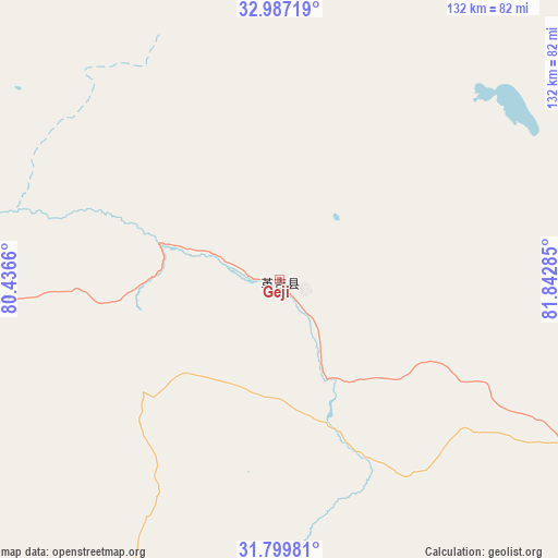
Geji GPS coordinates[2]
32° 23' 43.62" North, 81° 8' 22.992" East
| Map corner | latitude | longitude |
|---|---|---|
| Upper-left | 32.98719°, | 80.4366° |
| Center: | 32.39545°, | 81.13972° |
| Lower-right: | 31.79981°, | 81.84285° |
| Map W x H: | 132×132 km | = 82×82mi |
| max Lat: | 53.31946° ⇑36.5% North |
| Geji: | 32.39545° |
| min Lat: | ⇓63.5% South 18.22056° |
| min Long | Geji | max Long |
| 75.07348° | 81.13972° | 134.28917° |
| W 0.6%⇐ | ⇒99.4% E |
Elevation
Elevation of Geji is 4519 m = 14826 ft, and this is 4034.2 m = 13236 ft above average elevation for this country.
| Max E: |
5622 m = 18445 ft | 0.40000000000001% |
| Geji | 4519 m 14826 ft | |
| Avg. | 484.8 m = 1591 ft | |
Min E: |
-3 m = -10 ft | 99.6% |
See also: China elevation on elevation.city.
Geographical zone
Geji is located in North temperate zone (between Tropic of Cancer and the Arctic Circle). Distance of this Northern Tropic circle is 996.1 km =618.9 mi to South.| Distance of | km | miles | from Geji |
|---|---|---|---|
| North Pole | 6405 | 3979.9 | to North |
| Arctic Circle | 3799.1 | 2360.7 | to North |
| Tropic Cancer | 996.1 | 618.9 | to South |
| Equator | 3602 | 2238.2 | to South |


Nearby cities:
15 places around Geji: (largest is in red/bold)
• Burang
233.5 km =145.1 mi,  179°
179°
• Darchen
163.4 km =101.5 mi, 175°
• Diyag
233.7 km =145.2 mi,  250°
250°
• Gangsha
158.3 km =98.4 mi,  174°
174°
• Gar
106.4 km =66.1 mi, 253°
• Jisegumen
188.7 km =117.3 mi,  349°
349°
• Langjiu
67.1 km =41.7 mi,  266°
266°
• Lumaka
105.4 km =65.5 mi,  316°
316°
• Qumudi
185 km =115 mi,  263°
263°
• Rutog
180.4 km =112.1 mi,  309°
309°
• Shiquanhe
98.5 km =61.2 mi,  276°
276°
• Toding
162.4 km =100.9 mi,  231°
231°
• Xagmakajor
150.7 km =93.6 mi,  131°
131°
• Zangkaxa
162.8 km =101.2 mi,  334°
334°
• Zhabu
217.8 km =135.3 mi,  68°
68°
Sources, notices
• [Note1] Compared only with cities in China existing in our database
• [Src1] Map data: © OpenStreetMap contributors (CC-BY-SA)
• [Src2] Other city data from geonames.org with taken over terms of usage.
• [Src3] Geographical zone / Annual Mean Temperature by Robert A. Rohde @ Wikipedia
