Langjiu geodata
Langjiu (Tibet) is a seat of a fourth-order administrative division; located in China in Asia/Shanghai (GMT+8) time zone. In our database, there are 1268 cities with bigger population. Compared to other cities in China, 63.4% of cities are located further ↓South; 99.5% of cities are located further →East and 99.6% of cities have lower elevation than Langjiu. Note1


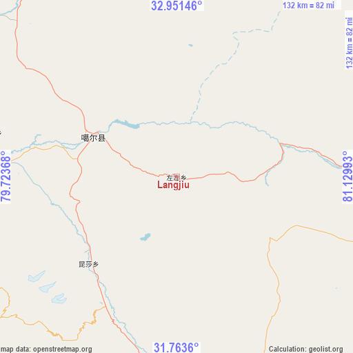
Langjiu GPS coordinates[2]
32° 21' 34.128" North, 80° 25' 36.48" East
| Map corner | latitude | longitude |
|---|---|---|
| Upper-left | 32.95146°, | 79.72368° |
| Center: | 32.35948°, | 80.4268° |
| Lower-right: | 31.7636°, | 81.12993° |
| Map W x H: | 132.1×132.1 km | = 82.1×82.1mi |
| max Lat: | 53.31946° ⇑36.6% North |
| Langjiu: | 32.35948° |
| min Lat: | ⇓63.4% South 18.22056° |
| min Long | Langjiu | max Long |
| 75.07348° | 80.4268° | 134.28917° |
| W 0.5%⇐ | ⇒99.5% E |
Elevation
Elevation of Langjiu is 4533 m = 14872 ft, and this is 4048.2 m = 13281 ft above average elevation for this country.
| Max E: |
5622 m = 18445 ft | 0.40000000000001% |
| Langjiu | 4533 m 14872 ft | |
| Avg. | 484.8 m = 1591 ft | |
Min E: |
-3 m = -10 ft | 99.6% |
See also: China elevation on elevation.city.
Geographical zone
Langjiu is located in North temperate zone (between Tropic of Cancer and the Arctic Circle). Distance of this Northern Tropic circle is 992.1 km =616.5 mi to South.| Distance of | km | miles | from Langjiu |
|---|---|---|---|
| North Pole | 6409 | 3982.4 | to North |
| Arctic Circle | 3803.1 | 2363.1 | to North |
| Tropic Cancer | 992.1 | 616.5 | to South |
| Equator | 3598 | 2235.7 | to South |


Nearby cities:
15 places around Langjiu: (largest is in red/bold)
• Burang
240.2 km =149.3 mi,  162°
162°
• Darchen
178.6 km =111 mi,  152°
152°
• Diyag
170 km =105.6 mi,  244°
244°
• Gangsha
174 km =108.1 mi, 152°
• Gar
43.9 km =27.3 mi,  232°
232°
• Geji
67.1 km =41.7 mi,  86°
86°
• Jisegumen
192.2 km =119.4 mi,  9°
9°
• Lumaka
81 km =50.3 mi,  356°
356°
• Qumudi
118.1 km =73.4 mi,  261°
261°
• Rutog
138.8 km =86.2 mi,  328°
328°
• Shiquanhe
34.7 km =21.6 mi,  297°
297°
• Toding
114.3 km =71 mi,  211°
211°
• Xagmakajor
203.9 km =126.7 mi,  118°
118°
• Zangkaxa
150.6 km =93.6 mi, 358°
• Zhabu
282 km =175.2 mi,  72°
72°
Sources, notices
• [Note1] Compared only with cities in China existing in our database
• [Src1] Map data: © OpenStreetMap contributors (CC-BY-SA)
• [Src2] Other city data from geonames.org with taken over terms of usage.
• [Src3] Geographical zone / Annual Mean Temperature by Robert A. Rohde @ Wikipedia
