Toding geodata
Toding (Tibet) is a seat of a third-order administrative division; located in China in Asia/Shanghai (GMT+8) time zone. In our database, there are 1268 cities with bigger population. Compared to other cities in China, 58.3% of cities are located further ↓South; 99.5% of cities are located further →East and 98.1% of cities have lower elevation than Toding. Note1


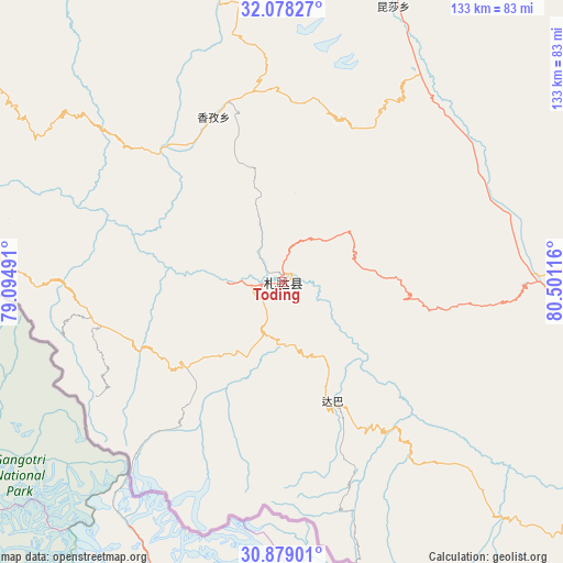
Toding GPS coordinates[2]
31° 28' 50.016" North, 79° 47' 52.908" East
| Map corner | latitude | longitude |
|---|---|---|
| Upper-left | 32.07827°, | 79.09491° |
| Center: | 31.48056°, | 79.79803° |
| Lower-right: | 30.87901°, | 80.50116° |
| Map W x H: | 133.3×133.3 km | = 82.8×82.8mi |
| max Lat: | 53.31946° ⇑41.7% North |
| Toding: | 31.48056° |
| min Lat: | ⇓58.3% South 18.22056° |
| min Long | Toding | max Long |
| 75.07348° | 79.79803° | 134.28917° |
| W 0.5%⇐ | ⇒99.5% E |
Elevation
Elevation of Toding is 3729 m = 12234 ft, and this is 3244.2 m = 10644 ft above average elevation for this country.
| Max E: |
5622 m = 18445 ft | 1.9% |
| Toding | 3729 m 12234 ft | |
| Avg. | 484.8 m = 1591 ft | |
Min E: |
-3 m = -10 ft | 98.1% |
See also: China elevation on elevation.city.
Geographical zone
Toding is located in North temperate zone (between Tropic of Cancer and the Arctic Circle). Distance of this Northern Tropic circle is 894.4 km =555.8 mi to South.| Distance of | km | miles | from Toding |
|---|---|---|---|
| North Pole | 6506.8 | 4043.1 | to North |
| Arctic Circle | 3900.9 | 2423.9 | to North |
| Tropic Cancer | 894.4 | 555.8 | to South |
| Equator | 3500.3 | 2175 | to South |


Nearby cities:
15 places around Toding: (largest is in red/bold)
• Burang
186.1 km =115.6 mi,  135°
135°
• Darchen
154.4 km =95.9 mi,  113°
113°
• Diyag
97.6 km =60.6 mi,  284°
284°
• Gangsha
152.3 km =94.6 mi, 111°
• Gar
75.1 km =46.7 mi,  18°
18°
• Geji
162.4 km =100.9 mi,  51°
51°
• Jisegumen
301.3 km =187.2 mi, 17°
• Langjiu
114.3 km =71 mi,  31°
31°
• Lumaka
186.4 km =115.8 mi, 16°
• Qumudi
98.9 km =61.5 mi,  324°
324°
• Rutog
216 km =134.2 mi,  356°
356°
• Shiquanhe
117 km =72.7 mi,  13°
13°
• Xagmakajor
240.3 km =149.3 mi,  89°
89°
• Zangkaxa
254.1 km =157.9 mi, 12°
• Zhabu
376.5 km =233.9 mi,  61°
61°
Sources, notices
• [Note1] Compared only with cities in China existing in our database
• [Src1] Map data: © OpenStreetMap contributors (CC-BY-SA)
• [Src2] Other city data from geonames.org with taken over terms of usage.
• [Src3] Geographical zone / Annual Mean Temperature by Robert A. Rohde @ Wikipedia
