Zhabu geodata
Zhabu (Tibet) is a seat of a fourth-order administrative division; located in China in Asia/Shanghai (GMT+8) time zone. In our database, there are 1268 cities with bigger population. Compared to other cities in China, 66.7% of cities are located further ↓South; 98.9% of cities are located further →East and 99.6% of cities have lower elevation than Zhabu. Note1


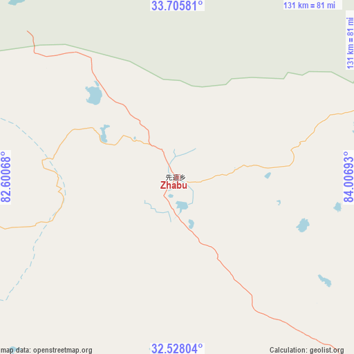
Zhabu GPS coordinates[2]
33° 7' 8.04" North, 83° 18' 13.68" East
| Map corner | latitude | longitude |
|---|---|---|
| Upper-left | 33.70581°, | 82.60068° |
| Center: | 33.1189°, | 83.3038° |
| Lower-right: | 32.52804°, | 84.00693° |
| Map W x H: | 131×131 km | = 81.4×81.4mi |
| max Lat: | 53.31946° ⇑33.3% North |
| Zhabu: | 33.1189° |
| min Lat: | ⇓66.7% South 18.22056° |
| min Long | Zhabu | max Long |
| 75.07348° | 83.3038° | 134.28917° |
| W 1.1%⇐ | ⇒98.9% E |
Elevation
Elevation of Zhabu is 4536 m = 14882 ft, and this is 4051.2 m = 13291 ft above average elevation for this country.
| Max E: |
5622 m = 18445 ft | 0.40000000000001% |
| Zhabu | 4536 m 14882 ft | |
| Avg. | 484.8 m = 1591 ft | |
Min E: |
-3 m = -10 ft | 99.6% |
See also: China elevation on elevation.city.
Geographical zone
Zhabu is located in North temperate zone (between Tropic of Cancer and the Arctic Circle). Distance of this Northern Tropic circle is 1076.6 km =669 mi to South.| Distance of | km | miles | from Zhabu |
|---|---|---|---|
| North Pole | 6324.6 | 3929.9 | to North |
| Arctic Circle | 3718.7 | 2310.7 | to North |
| Tropic Cancer | 1076.6 | 669 | to South |
| Equator | 3682.5 | 2288.2 | to South |


Nearby cities:
15 places around Zhabu: (largest is in red/bold)
• Burang
372.9 km =231.7 mi,  212°
212°
• Darchen
308.6 km =191.8 mi,  217°
217°
• Gangsha
304.7 km =189.3 mi, 218°
• Gar
323.8 km =201.2 mi,  249°
249°
• Geji
217.8 km =135.3 mi, 248°
• Jisegumen
257 km =159.7 mi,  294°
294°
• Langjiu
282 km =175.2 mi, 252°
• Lumaka
273.5 km =169.9 mi,  269°
269°
• Luring
126.5 km =78.6 mi,  138°
138°
• Maindong
280.9 km =174.5 mi,  134°
134°
• Rutog
342.3 km =212.7 mi,  275°
275°
• Shiquanhe
307.4 km =191 mi,  257°
257°
• Toding
376.5 km =233.9 mi,  241°
241°
• Xagmakajor
202.4 km =125.8 mi, 206°
• Zangkaxa
279.6 km =173.7 mi, 283°
Sources, notices
• [Note1] Compared only with cities in China existing in our database
• [Src1] Map data: © OpenStreetMap contributors (CC-BY-SA)
• [Src2] Other city data from geonames.org with taken over terms of usage.
• [Src3] Geographical zone / Annual Mean Temperature by Robert A. Rohde @ Wikipedia
