Madoi geodata
Madoi (Qinghai) is a seat of a fourth-order administrative division; located in China in Asia/Shanghai (GMT+8) time zone. In our database, there are 1268 cities with bigger population. Compared to other cities in China, 75.1% of cities are located further ↓South; 95.8% of cities are located further →East and 99.5% of cities have lower elevation than Madoi. Note1


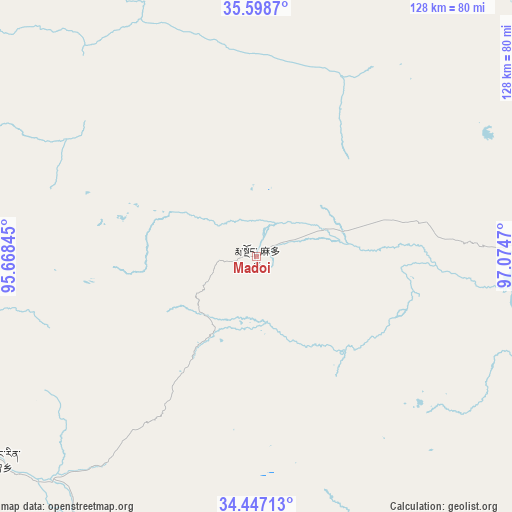
Madoi GPS coordinates[2]
35° 1' 29.784" North, 96° 22' 17.652" East
| Map corner | latitude | longitude |
|---|---|---|
| Upper-left | 35.5987°, | 95.66845° |
| Center: | 35.02494°, | 96.37157° |
| Lower-right: | 34.44713°, | 97.0747° |
| Map W x H: | 128×128 km | = 79.5×79.5mi |
| max Lat: | 53.31946° ⇑24.9% North |
| Madoi: | 35.02494° |
| min Lat: | ⇓75.1% South 18.22056° |
| min Long | Madoi | max Long |
| 75.07348° | 96.37157° | 134.28917° |
| W 4.2%⇐ | ⇒95.8% E |
Elevation
Elevation of Madoi is 4446 m = 14587 ft, and this is 3961.2 m = 12996 ft above average elevation for this country.
| Max E: |
5622 m = 18445 ft | 0.5% |
| Madoi | 4446 m 14587 ft | |
| Avg. | 484.8 m = 1591 ft | |
Min E: |
-3 m = -10 ft | 99.5% |
See also: China elevation on elevation.city.
Geographical zone
Madoi is located in North temperate zone (between Tropic of Cancer and the Arctic Circle). Distance of this Northern Tropic circle is 1288.5 km =800.6 mi to South.| Distance of | km | miles | from Madoi |
|---|---|---|---|
| North Pole | 6112.7 | 3798.3 | to North |
| Arctic Circle | 3506.8 | 2179 | to North |
| Tropic Cancer | 1288.5 | 800.6 | to South |
| Equator | 3894.4 | 2419.9 | to South |


Nearby cities:
15 places around Madoi: (largest is in red/bold)
• Bagan
126.1 km =78.4 mi,  173°
173°
• Barun
138 km =85.7 mi,  43°
43°
• Dongfeng
104.8 km =65.1 mi,  187°
187°
• Duocai
160.7 km =99.9 mi,  212°
212°
• Gaduo
153.1 km =95.1 mi, 168°
• Heihe
162.3 km =100.8 mi,  98°
98°
• Linxin
160.8 km =99.9 mi, 190°
• Nomhon
149.7 km =93 mi,  1°
1°
• Qigzhi
82.6 km =51.3 mi,  232°
232°
• Qingshuihe
152.8 km =94.9 mi,  152°
152°
• Yege
106.5 km =66.2 mi,  241°
241°
• Zadoi
143.7 km =89.3 mi, 166°
• Zhalinghu
140 km =87 mi,  87°
87°
• Zhiqu
112.5 km =69.9 mi,  224°
224°
• Zongjia
146 km =90.7 mi,  20°
20°
Sources, notices
• [Note1] Compared only with cities in China existing in our database
• [Src1] Map data: © OpenStreetMap contributors (CC-BY-SA)
• [Src2] Other city data from geonames.org with taken over terms of usage.
• [Src3] Geographical zone / Annual Mean Temperature by Robert A. Rohde @ Wikipedia
