Zongga geodata
Zongga (Tibet) is a seat of a third-order administrative division; located in China in Asia/Shanghai (GMT+8) time zone. In our database, there are 1268 cities with bigger population. Compared to other cities in China, 65.5% of cities are located further ↑North; 98.5% of cities are located further →East and 100% of cities have lower elevation than Zongga. Note1


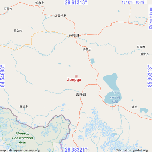
Zongga GPS coordinates[2]
29° 0' 0" North, 85° 15' 0" East
| Map corner | latitude | longitude |
|---|---|---|
| Upper-left | 29.61313°, | 84.54688° |
| Center: | 29°, | 85.25° |
| Lower-right: | 28.38321°, | 85.95313° |
| Map W x H: | 136.8×136.8 km | = 85×85mi |
| max Lat: | 53.31946° ⇑65.5% North |
| Zongga: | 29° |
| min Lat: | ⇓34.5% South 18.22056° |
| min Long | Zongga | max Long |
| 75.07348° | 85.25° | 134.28917° |
| W 1.5%⇐ | ⇒98.5% E |
Elevation
Elevation of Zongga is 5622 m = 18445 ft, and this is 5137.2 m = 16854 ft above average elevation for this country.
| Max E: |
5622 m = 18445 ft | 0% |
| Zongga | 5622 m 18445 ft | |
| Avg. | 484.8 m = 1591 ft | |
Min E: |
-3 m = -10 ft | 100% |
See also: China elevation on elevation.city.
Geographical zone
Zongga is located in North temperate zone (between Tropic of Cancer and the Arctic Circle). Distance of this Northern Tropic circle is 618.6 km =384.4 mi to South.| Distance of | km | miles | from Zongga |
|---|---|---|---|
| North Pole | 6782.6 | 4214.5 | to North |
| Arctic Circle | 4176.7 | 2595.3 | to North |
| Tropic Cancer | 618.6 | 384.4 | to South |
| Equator | 3224.5 | 2003.6 | to South |


Nearby cities:
15 places around Zongga: (largest is in red/bold)
• Camgyai
151.3 km =94 mi,  137°
137°
• Chongdui
117.6 km =73.1 mi, 143°
• Gangba
326.6 km =202.9 mi,  105°
105°
• Gyangkar
257.5 km =160 mi, 105°
• Jiding
294.1 km =182.7 mi,  82°
82°
• Kambaxoi
329.7 km =204.9 mi,  103°
103°
• Maindong
259.9 km =161.5 mi,  3°
3°
• Ngamring
188 km =116.8 mi, 82°
• Quxar
233.5 km =145.1 mi,  87°
87°
• Saga
36.1 km =22.4 mi,  356°
356°
• Sajia
272.6 km =169.4 mi, 91°
• Xêgar
183.2 km =113.8 mi, 102°
• Zhadong
127.5 km =79.2 mi,  304°
304°
• Zham
133.8 km =83.1 mi,  147°
147°
• Zuobude
151.2 km =94 mi, 137°
Sources, notices
• [Note1] Compared only with cities in China existing in our database
• [Src1] Map data: © OpenStreetMap contributors (CC-BY-SA)
• [Src2] Other city data from geonames.org with taken over terms of usage.
• [Src3] Geographical zone / Annual Mean Temperature by Robert A. Rohde @ Wikipedia
