Une geodata
Une (Cundinamarca) is a seat of a second-order administrative division; located in Colombia in America/Bogota (GMT-5) time zone. With population of 3,208 people, there are 663 cities with bigger population in this country. Compared to other cities in Colombia, 72.9% of cities are located further ↑North; 64.6% of cities are located further ←West and 86.3% of cities have lower elevation than Une. Note1


Une GPS coordinates[2]
4° 24' 11.016" North, 74° 1' 31.008" West
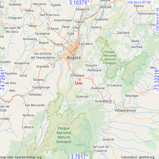
| Map corner | latitude | longitude |
|---|---|---|
| Upper-left | 5.10376°, | -74.72841° |
| Center: | 4.40306°, | -74.02528° |
| Lower-right: | 3.7017°, | -73.32216° |
| Map W x H: | 155.9×155.9 km | = 96.9×96.9mi |
| max Lat: | 13.38166° ⇑72.9% North |
| Une: | 4.40306° |
| min Lat: | ⇓27.1% South -4.21528° |
| min Long | Une | max Long |
| -81.70636° | -74.02528° | -67.06996° |
| W 64.6%⇐ | ⇒35.4% E |
Elevation
Elevation of Une is 2371 m = 7779 ft, and this is 1221.7 m = 4008 ft above average elevation for this country.
| Max E: |
3342 m = 10965 ft | 13.7% |
| Une | 2371 m 7779 ft | |
| Avg. | 1149.3 m = 3771 ft | |
Min E: |
1 m = 3 ft | 86.3% |
See also: Colombia elevation on elevation.city.
Geographical zone
Une is located in North Torrid zone (between Equator and Tropic of Cancer). Distance of Equator is 489.6 km =304.2 mi to South.| Distance of | km | miles | from Une |
|---|---|---|---|
| North Pole | 9517.5 | 5913.9 | to North |
| Arctic Circle | 6911.6 | 4294.7 | to North |
| Tropic Cancer | 2116.3 | 1315 | to North |
| Equator | 489.6 | 304.2 | to South |


Nearby cities:
15 places around Une: (largest is in red/bold)
• Barrio San Luis
29.4 km =18.3 mi,  0°
0°
• Bogotá
23.8 km =14.8 mi,  344°
344°
• Chipaque
4.9 km =3 mi,  334°
334°
• Choachí
18 km =11.2 mi,  39°
39°
• Cáqueza
8.7 km =5.4 mi,  88°
88°
• El Calvario
35.2 km =21.9 mi,  99°
99°
• Fosca
12 km =7.5 mi,  126°
126°
• Fómeque
17 km =10.6 mi,  56°
56°
• Guayabetal
31.2 km =19.4 mi, 132°
• Gutiérrez
16.7 km =10.4 mi,  171°
171°
• Pasca
32.3 km =20.1 mi,  250°
250°
• Quetame
19.8 km =12.3 mi,  113°
113°
• Sibaté
27.8 km =17.3 mi,  290°
290°
• Soacha
28.9 km =18 mi,  312°
312°
• Ubaque
13.5 km =8.4 mi,  46°
46°
Sources, notices
• [Note1] Compared only with cities in Colombia existing in our database
• [Src1] Map data: © OpenStreetMap contributors (CC-BY-SA)
• [Src2] Other city data from geonames.org with taken over terms of usage.
• [Src3] Geographical zone / Annual Mean Temperature by Robert A. Rohde @ Wikipedia
