San Luis de Palenque geodata
San Luis de Palenque (Casanare) is a seat of a second-order administrative division; located in Colombia in America/Bogota (GMT-5) time zone. With population of 2,032 people, there are 794 cities with bigger population in this country. Compared to other cities in Colombia, 51.9% of cities are located further ↑North; 98.5% of cities are located further ←West and 75.8% of cities have higher elevation than San Luis de Palenque. Note1


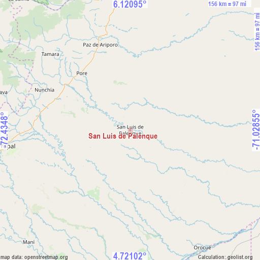
San Luis de Palenque GPS coordinates[2]
5° 25' 17.004" North, 71° 43' 54.012" West
| Map corner | latitude | longitude |
|---|---|---|
| Upper-left | 6.12095°, | -72.4348° |
| Center: | 5.42139°, | -71.73167° |
| Lower-right: | 4.72102°, | -71.02855° |
| Map W x H: | 155.7×155.7 km | = 96.7×96.7mi |
| max Lat: | 13.38166° ⇑51.9% North |
| San Luis de Palenque: | 5.42139° |
| min Lat: | ⇓48.1% South -4.21528° |
| min Long | San Luis de Pal | max Long |
| -81.70636° | -71.73167° | -67.06996° |
| W 98.5%⇐ | ⇒1.5% E |
Elevation
Elevation of San Luis de Palenque is 173 m = 568 ft, and this is 976.3 m = 3203 ft below average elevation for this country.
| Max E: |
3342 m = 10965 ft | 75.8% |
| Avg. | 1149.3 m = 3771 ft | |
| San Luis de Palenque | 173 m = 568 ft | |
Min E: |
1 m = 3 ft | 24.2% |
See also: Colombia elevation on elevation.city.
Geographical zone
San Luis de Palenque is located in North Torrid zone (between Equator and Tropic of Cancer). Distance of Equator is 602.8 km =374.6 mi to South.| Distance of | km | miles | from San Luis de Palenque |
|---|---|---|---|
| North Pole | 9404.3 | 5843.6 | to North |
| Arctic Circle | 6798.4 | 4224.3 | to North |
| Tropic Cancer | 2003.1 | 1244.7 | to North |
| Equator | 602.8 | 374.6 | to South |


Nearby cities:
15 places around San Luis de Palenque: (largest is in red/bold)
• Aguazul
94.4 km =58.7 mi,  252°
252°
• Labranzagrande
94.6 km =58.8 mi,  279°
279°
• Maní
90.6 km =56.3 mi,  222°
222°
• Municipio Hato Corozal
81.8 km =50.8 mi,  357°
357°
• Nunchía
56.6 km =35.2 mi,  294°
294°
• Orocué
82.5 km =51.3 mi,  148°
148°
• Paya
79.8 km =49.6 mi, 286°
• Paz de Ariporo
54.1 km =33.6 mi,  340°
340°
• Pisba
90 km =55.9 mi, 291°
• Pore
44.7 km =27.8 mi,  319°
319°
• Sácama
94.6 km =58.8 mi, 322°
• Trinidad
7.8 km =4.8 mi,  100°
100°
• Támara
65.9 km =40.9 mi,  313°
313°
• Villanueva
30.2 km =18.8 mi,  239°
239°
• Yopal
74.1 km =46 mi,  262°
262°
Sources, notices
• [Note1] Compared only with cities in Colombia existing in our database
• [Src1] Map data: © OpenStreetMap contributors (CC-BY-SA)
• [Src2] Other city data from geonames.org with taken over terms of usage.
• [Src3] Geographical zone / Annual Mean Temperature by Robert A. Rohde @ Wikipedia
