Castilla La Nueva geodata
Castilla La Nueva (Meta) is a seat of a second-order administrative division; located in Colombia in America/Bogota (GMT-5) time zone. With population of 1,543 people, there are 860 cities with bigger population in this country. Compared to other cities in Colombia, 79.4% of cities are located further ↑North; 71.7% of cities are located further ←West and 65.6% of cities have higher elevation than Castilla La Nueva. Note1


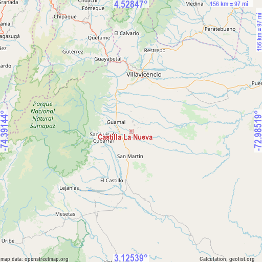
Castilla La Nueva GPS coordinates[2]
3° 49' 37.992" North, 73° 41' 17.916" West
| Map corner | latitude | longitude |
|---|---|---|
| Upper-left | 4.52847°, | -74.39144° |
| Center: | 3.82722°, | -73.68831° |
| Lower-right: | 3.12539°, | -72.98519° |
| Map W x H: | 156×156 km | = 96.9×96.9mi |
| max Lat: | 13.38166° ⇑79.4% North |
| Castilla La Nueva: | 3.82722° |
| min Lat: | ⇓20.6% South -4.21528° |
| min Long | Castilla La Nue | max Long |
| -81.70636° | -73.68831° | -67.06996° |
| W 71.7%⇐ | ⇒28.3% E |
Elevation
Elevation of Castilla La Nueva is 417 m = 1368 ft, and this is 732.3 m = 2403 ft below average elevation for this country.
| Max E: |
3342 m = 10965 ft | 65.6% |
| Avg. | 1149.3 m = 3771 ft | |
| Castilla La Nueva | 417 m = 1368 ft | |
Min E: |
1 m = 3 ft | 34.4% |
See also: Colombia elevation on elevation.city.
Geographical zone
Castilla La Nueva is located in North Torrid zone (between Equator and Tropic of Cancer). Distance of Equator is 425.5 km =264.4 mi to South.| Distance of | km | miles | from Castilla La Nueva |
|---|---|---|---|
| North Pole | 9581.5 | 5953.7 | to North |
| Arctic Circle | 6975.6 | 4334.4 | to North |
| Tropic Cancer | 2180.4 | 1354.8 | to North |
| Equator | 425.5 | 264.4 | to South |


Nearby cities:
15 places around Castilla La Nueva: (largest is in red/bold)
• Acacías
19.4 km =12.1 mi,  336°
336°
• Cubarral
17.3 km =10.7 mi,  258°
258°
• Cumaral
54.2 km =33.7 mi,  24°
24°
• El Castillo
31.6 km =19.6 mi,  201°
201°
• El Dorado
19 km =11.8 mi,  238°
238°
• Fuente de Oro
41.2 km =25.6 mi,  169°
169°
• Granada
31.3 km =19.4 mi,  183°
183°
• Guamal
10.4 km =6.5 mi,  304°
304°
• Guayabetal
45.4 km =28.2 mi, 341°
• Lejanías
49.9 km =31 mi,  228°
228°
• Restrepo
50 km =31.1 mi, 16°
• San Carlos de Guaroa
51 km =31.7 mi,  104°
104°
• San Juan de Arama
54.8 km =34.1 mi, 201°
• San Martín
14.6 km =9.1 mi, 184°
• Villavicencio
35.7 km =22.2 mi,  11°
11°
Sources, notices
• [Note1] Compared only with cities in Colombia existing in our database
• [Src1] Map data: © OpenStreetMap contributors (CC-BY-SA)
• [Src2] Other city data from geonames.org with taken over terms of usage.
• [Src3] Geographical zone / Annual Mean Temperature by Robert A. Rohde @ Wikipedia
