Restrepo geodata
Restrepo (Meta) is a seat of a second-order administrative division; located in Colombia in America/Bogota (GMT-5) time zone. With population of 7,511 people, there are 390 cities with bigger population in this country. Compared to other cities in Colombia, 75.6% of cities are located further ↑North; 74.2% of cities are located further ←West and 64.3% of cities have higher elevation than Restrepo. Note1


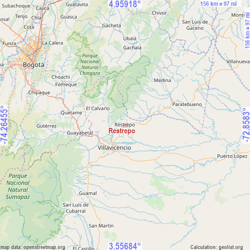
Restrepo GPS coordinates[2]
4° 15' 29.988" North, 73° 33' 41.112" West
| Map corner | latitude | longitude |
|---|---|---|
| Upper-left | 4.95918°, | -74.26455° |
| Center: | 4.25833°, | -73.56142° |
| Lower-right: | 3.55684°, | -72.8583° |
| Map W x H: | 155.9×155.9 km | = 96.9×96.9mi |
| max Lat: | 13.38166° ⇑75.6% North |
| Restrepo: | 4.25833° |
| min Lat: | ⇓24.4% South -4.21528° |
| min Long | Restrepo | max Long |
| -81.70636° | -73.56142° | -67.06996° |
| W 74.2%⇐ | ⇒25.8% E |
Elevation
Elevation of Restrepo is 474 m = 1555 ft, and this is 675.3 m = 2216 ft below average elevation for this country.
| Max E: |
3342 m = 10965 ft | 64.3% |
| Avg. | 1149.3 m = 3771 ft | |
| Restrepo | 474 m = 1555 ft | |
Min E: |
1 m = 3 ft | 35.7% |
See also: Colombia elevation on elevation.city.
Geographical zone
Restrepo is located in North Torrid zone (between Equator and Tropic of Cancer). Distance of Equator is 473.5 km =294.2 mi to South.| Distance of | km | miles | from Restrepo |
|---|---|---|---|
| North Pole | 9533.6 | 5923.9 | to North |
| Arctic Circle | 6927.7 | 4304.7 | to North |
| Tropic Cancer | 2132.4 | 1325 | to North |
| Equator | 473.5 | 294.2 | to South |


Nearby cities:
15 places around Restrepo: (largest is in red/bold)
• Acacías
37.2 km =23.1 mi,  215°
215°
• Cumaral
8.4 km =5.2 mi,  80°
80°
• Cáqueza
45.8 km =28.5 mi,  290°
290°
• El Calvario
19.7 km =12.2 mi,  302°
302°
• Fosca
42.8 km =26.6 mi,  282°
282°
• Fómeque
45.2 km =28.1 mi, 304°
• Gachalá
48.5 km =30.1 mi,  5°
5°
• Guamal
47.7 km =29.6 mi,  208°
208°
• Guayabetal
28.8 km =17.9 mi,  260°
260°
• Medina
36.5 km =22.7 mi,  39°
39°
• Paratebueno
40.5 km =25.2 mi,  71°
71°
• Quetame
34.3 km =21.3 mi, 283°
• San Juanito
26.1 km =16.2 mi,  329°
329°
• Ubaque
48.8 km =30.3 mi, 301°
• Villavicencio
14.8 km =9.2 mi, 209°
Sources, notices
• [Note1] Compared only with cities in Colombia existing in our database
• [Src1] Map data: © OpenStreetMap contributors (CC-BY-SA)
• [Src2] Other city data from geonames.org with taken over terms of usage.
• [Src3] Geographical zone / Annual Mean Temperature by Robert A. Rohde @ Wikipedia
