La Primavera geodata
La Primavera (Vichada) is a seat of a second-order administrative division; located in Colombia in America/Bogota (GMT-5) time zone. With population of 3,920 people, there are 592 cities with bigger population in this country. Compared to other cities in Colombia, 50.9% of cities are located further ↑North; 99.2% of cities are located further ←West and 79.9% of cities have higher elevation than La Primavera. Note1


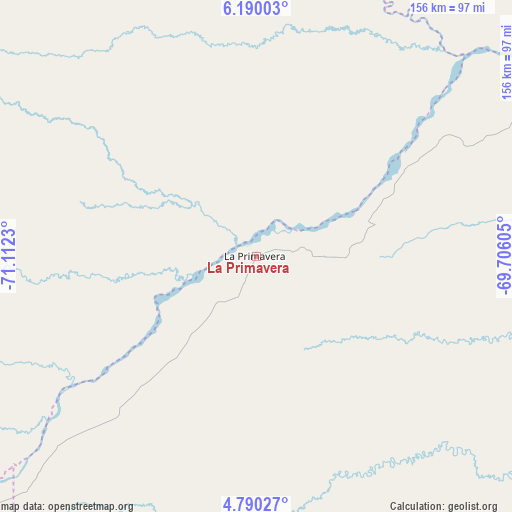
La Primavera GPS coordinates[2]
5° 29' 26.016" North, 70° 24' 33.012" West
| Map corner | latitude | longitude |
|---|---|---|
| Upper-left | 6.19003°, | -71.1123° |
| Center: | 5.49056°, | -70.40917° |
| Lower-right: | 4.79027°, | -69.70605° |
| Map W x H: | 155.6×155.6 km | = 96.7×96.7mi |
| max Lat: | 13.38166° ⇑50.9% North |
| La Primavera: | 5.49056° |
| min Lat: | ⇓49.1% South -4.21528° |
| min Long | La Primavera | max Long |
| -81.70636° | -70.40917° | -67.06996° |
| W 99.2%⇐ | ⇒0.8% E |
Elevation
Elevation of La Primavera is 118 m = 387 ft, and this is 1031.3 m = 3384 ft below average elevation for this country.
| Max E: |
3342 m = 10965 ft | 79.9% |
| Avg. | 1149.3 m = 3771 ft | |
| La Primavera | 118 m = 387 ft | |
Min E: |
1 m = 3 ft | 20.1% |
See also: Colombia elevation on elevation.city.
Geographical zone
La Primavera is located in North Torrid zone (between Equator and Tropic of Cancer). Distance of Equator is 610.5 km =379.3 mi to South.| Distance of | km | miles | from La Primavera |
|---|---|---|---|
| North Pole | 9396.6 | 5838.8 | to North |
| Arctic Circle | 6790.7 | 4219.5 | to North |
| Tropic Cancer | 1995.4 | 1239.9 | to North |
| Equator | 610.5 | 379.3 | to South |


Nearby cities:
15 places around La Primavera: (largest is in red/bold)
• Arauca
181.4 km =112.7 mi,  347°
347°
• Cravo Norte
93 km =57.8 mi,  14°
14°
• Cumaribo
134.4 km =83.5 mi,  149°
149°
• Municipio Hato Corozal
167.1 km =103.8 mi,  296°
296°
• Nunchía
198.3 km =123.2 mi,  274°
274°
• Orocué
129.1 km =80.2 mi,  232°
232°
• Paz de Ariporo
169.7 km =105.4 mi,  284°
284°
• Pore
177.2 km =110.1 mi, 278°
• Puerto Rondón
116.4 km =72.3 mi,  318°
318°
• San Luis de Palenque
146.6 km =91.1 mi, 266°
• Santa Rosalia
64 km =39.8 mi, 231°
• Tame
182.1 km =113.2 mi,  306°
306°
• Trinidad
139 km =86.4 mi, 266°
• Támara
197.7 km =122.8 mi, 281°
• Villanueva
173.9 km =108.1 mi,  262°
262°
Sources, notices
• [Note1] Compared only with cities in Colombia existing in our database
• [Src1] Map data: © OpenStreetMap contributors (CC-BY-SA)
• [Src2] Other city data from geonames.org with taken over terms of usage.
• [Src3] Geographical zone / Annual Mean Temperature by Robert A. Rohde @ Wikipedia
