Cruces de Anorí geodata
Cruces de Anorí (Antioquia) is a populated place; located in Colombia in America/Bogota (GMT-5) time zone. With population of 4,762 people, there are 528 cities with bigger population in this country. Compared to other cities in Colombia, 76% of cities are located further ↓South; 55.7% of cities are located further →East and 58.8% of cities have higher elevation than Cruces de Anorí. Note1


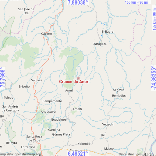
Cruces de Anorí GPS coordinates[2]
7° 10' 59.988" North, 75° 4' 0.012" West
| Map corner | latitude | longitude |
|---|---|---|
| Upper-left | 7.88038°, | -75.7698° |
| Center: | 7.18333°, | -75.06667° |
| Lower-right: | 6.48521°, | -74.36355° |
| Map W x H: | 155.1×155.1 km | = 96.4×96.4mi |
| max Lat: | 13.38166° ⇑24% North |
| Cruces de Anorí: | 7.18333° |
| min Lat: | ⇓76% South -4.21528° |
| min Long | Cruces de Anor� | max Long |
| -81.70636° | -75.06667° | -67.06996° |
| W 44.3%⇐ | ⇒55.7% E |
Elevation
Elevation of Cruces de Anorí is 853 m = 2799 ft, and this is 296.3 m = 972 ft below average elevation for this country.
| Max E: |
3342 m = 10965 ft | 58.8% |
| Avg. | 1149.3 m = 3771 ft | |
| Cruces de Anorí | 853 m = 2799 ft | |
Min E: |
1 m = 3 ft | 41.2% |
See also: Colombia elevation on elevation.city.
Geographical zone
Cruces de Anorí is located in North Torrid zone (between Equator and Tropic of Cancer). Distance of Equator is 798.7 km =496.3 mi to South.| Distance of | km | miles | from Cruces de Anorí |
|---|---|---|---|
| North Pole | 9208.4 | 5721.8 | to North |
| Arctic Circle | 6602.5 | 4102.6 | to North |
| Tropic Cancer | 1807.2 | 1122.9 | to North |
| Equator | 798.7 | 496.3 | to South |


Nearby cities:
15 places around Cruces de Anorí: (largest is in red/bold)
• Amalfi
30.4 km =18.9 mi,  182°
182°
• Angostura
44.4 km =27.6 mi,  221°
221°
• Anorí
15.2 km =9.4 mi, 216°
• Briceño
54.1 km =33.6 mi,  261°
261°
• Campamento
34.1 km =21.2 mi,  228°
228°
• Cáceres
54 km =33.6 mi,  324°
324°
• El Bagre
54.6 km =33.9 mi,  31°
31°
• Guadalupe
45.3 km =28.1 mi,  205°
205°
• Remedios
44.6 km =27.7 mi,  112°
112°
• Segovia
42.2 km =26.2 mi, 105°
• Valdivia
37.9 km =23.5 mi,  288°
288°
• Valdivia
41.1 km =25.5 mi,  267°
267°
• Vegachí
55.7 km =34.6 mi,  147°
147°
• Yarumal
45.8 km =28.5 mi,  237°
237°
• Zaragoza
40.4 km =25.1 mi, 32°
Sources, notices
• [Note1] Compared only with cities in Colombia existing in our database
• [Src1] Map data: © OpenStreetMap contributors (CC-BY-SA)
• [Src2] Other city data from geonames.org with taken over terms of usage.
• [Src3] Geographical zone / Annual Mean Temperature by Robert A. Rohde @ Wikipedia
