Playarrica geodata
Playarrica (Tolima) is a populated place; located in Colombia in America/Bogota (GMT-5) time zone. With population of 5,381 people, there are 483 cities with bigger population in this country. Compared to other cities in Colombia, 77.6% of cities are located further ↑North; 64.1% of cities are located further →East and 52.2% of cities have higher elevation than Playarrica. Note1


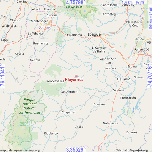
Playarrica GPS coordinates[2]
4° 3' 24.984" North, 75° 24' 37.008" West
| Map corner | latitude | longitude |
|---|---|---|
| Upper-left | 4.75798°, | -76.11341° |
| Center: | 4.05694°, | -75.41028° |
| Lower-right: | 3.35529°, | -74.70716° |
| Map W x H: | 156×156 km | = 96.9×96.9mi |
| max Lat: | 13.38166° ⇑77.6% North |
| Playarrica: | 4.05694° |
| min Lat: | ⇓22.4% South -4.21528° |
| min Long | Playarrica | max Long |
| -81.70636° | -75.41028° | -67.06996° |
| W 35.9%⇐ | ⇒64.1% E |
Elevation
Elevation of Playarrica is 1049 m = 3442 ft, and this is 100.3 m = 329 ft below average elevation for this country.
| Max E: |
3342 m = 10965 ft | 52.2% |
| Avg. | 1149.3 m = 3771 ft | |
| Playarrica | 1049 m = 3442 ft | |
Min E: |
1 m = 3 ft | 47.8% |
See also: Colombia elevation on elevation.city.
Geographical zone
Playarrica is located in North Torrid zone (between Equator and Tropic of Cancer). Distance of Equator is 451.1 km =280.3 mi to South.| Distance of | km | miles | from Playarrica |
|---|---|---|---|
| North Pole | 9556 | 5937.8 | to North |
| Arctic Circle | 6950.1 | 4318.6 | to North |
| Tropic Cancer | 2154.8 | 1338.9 | to North |
| Equator | 451.1 | 280.3 | to South |


Nearby cities:
15 places around Playarrica: (largest is in red/bold)
• Anaime
37.9 km =23.5 mi,  354°
354°
• Cajamarca
42.9 km =26.7 mi,  357°
357°
• Chaparral
38 km =23.6 mi,  192°
192°
• Coello
40.6 km =25.2 mi,  18°
18°
• Coyaima
37.3 km =23.2 mi,  140°
140°
• Génova
45.2 km =28.1 mi,  291°
291°
• Laureles
24.5 km =15.2 mi, 23°
• Ortega
24.9 km =15.5 mi,  122°
122°
• Payandé
43.9 km =27.3 mi,  52°
52°
• Pijao
44.8 km =27.8 mi,  313°
313°
• Roncesvalles
22.2 km =13.8 mi,  256°
256°
• Rovira
27.7 km =17.2 mi,  42°
42°
• San Antonio
17.7 km =11 mi,  206°
206°
• San Luis
36 km =22.4 mi,  76°
76°
• Valle de San Juan
36.1 km =22.4 mi,  64°
64°
Sources, notices
• [Note1] Compared only with cities in Colombia existing in our database
• [Src1] Map data: © OpenStreetMap contributors (CC-BY-SA)
• [Src2] Other city data from geonames.org with taken over terms of usage.
• [Src3] Geographical zone / Annual Mean Temperature by Robert A. Rohde @ Wikipedia
