Áchna geodata
Áchna (Ammochostos) is a populated place; located in Cyprus in Asia/Famagusta (GMT+2) time zone. With population of 2,043 people, there are 48 cities with bigger population in this country. Compared to other cities in Cyprus, 75.2% of cities are located further ↓South; 88.9% of cities are located further ←West and 77.8% of cities have higher elevation than Áchna. Note1


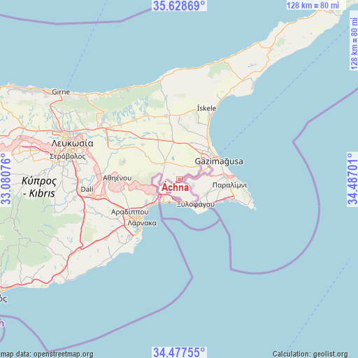
Áchna GPS coordinates[2]
35° 3' 18.54" North, 33° 47' 1.968" East
| Map corner | latitude | longitude |
|---|---|---|
| Upper-left | 35.62869°, | 33.08076° |
| Center: | 35.05515°, | 33.78388° |
| Lower-right: | 34.47755°, | 34.48701° |
| Map W x H: | 128×128 km | = 79.5×79.5mi |
| max Lat: | 35.59719° ⇑24.8% North |
| Áchna: | 35.05515° |
| min Lat: | ⇓75.2% South 34.66865° |
| min Long | Áchna | max Long |
| 32.38166° | 33.78388° | 34.37916° |
| W 88.9%⇐ | ⇒11.1% E |
Elevation
Elevation of Áchna is 50 m = 164 ft, and this is 158 m = 518 ft below average elevation for this country.
| Max E: |
1134 m = 3720 ft | 77.8% |
| Avg. | 208 m = 682 ft | |
| Áchna | 50 m = 164 ft | |
Min E: |
4 m = 13 ft | 22.2% |
See also: Cyprus elevation on elevation.city.
Geographical zone
Áchna is located in North temperate zone (between Tropic of Cancer and the Arctic Circle). Distance of this Northern Tropic circle is 1291.8 km =802.7 mi to South.| Distance of | km | miles | from Áchna |
|---|---|---|---|
| North Pole | 6109.3 | 3796.1 | to North |
| Arctic Circle | 3503.4 | 2176.9 | to North |
| Tropic Cancer | 1291.8 | 802.7 | to South |
| Equator | 3897.8 | 2422 | to South |


Nearby cities:
15 places around Áchna: (largest is in red/bold)
• Acherítou
8.7 km =5.4 mi,  54°
54°
• Avgórou
5.5 km =3.4 mi,  112°
112°
• Derýneia
16.1 km =10 mi,  86°
86°
• Famagusta
15.9 km =9.9 mi,  62°
62°
• Frénaros
12.7 km =7.9 mi,  97°
97°
• Larnaca
20.7 km =12.9 mi,  224°
224°
• Liopétri
11.2 km =7 mi,  117°
117°
• Livádia
18.4 km =11.4 mi,  231°
231°
• Paralímni
18.1 km =11.2 mi, 95°
• Pérgamos
7 km =4.3 mi,  257°
257°
• Pýla
9.6 km =6 mi,  240°
240°
• Troúlloi
15.6 km =9.7 mi, 260°
• Voróklini
14.1 km =8.8 mi, 236°
• Xylofágou
10.5 km =6.5 mi,  145°
145°
• Xylotymbou
5.7 km =3.5 mi, 221°
Sources, notices
• [Note1] Compared only with cities in Cyprus existing in our database
• [Src1] Map data: © OpenStreetMap contributors (CC-BY-SA)
• [Src2] Other city data from geonames.org with taken over terms of usage.
• [Src3] Geographical zone / Annual Mean Temperature by Robert A. Rohde @ Wikipedia
