Liopétri geodata
Liopétri (Ammochostos) is a populated place; located in Cyprus in Asia/Famagusta (GMT+3) time zone. With population of 4,005 people, there are 28 cities with bigger population in this country. Compared to other cities in Cyprus, 59% of cities are located further ↓South; 93.2% of cities are located further ←West and 80.3% of cities have higher elevation than Liopétri. Note1


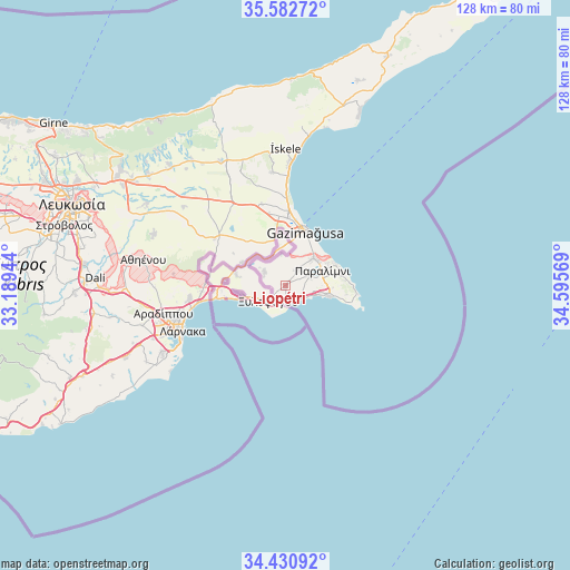
Liopétri GPS coordinates[2]
35° 0' 31.86" North, 33° 53' 33.216" East
| Map corner | latitude | longitude |
|---|---|---|
| Upper-left | 35.58272°, | 33.18944° |
| Center: | 35.00885°, | 33.89256° |
| Lower-right: | 34.43092°, | 34.59569° |
| Map W x H: | 128.1×128.1 km | = 79.6×79.6mi |
| max Lat: | 35.59719° ⇑41% North |
| Liopétri: | 35.00885° |
| min Lat: | ⇓59% South 34.66865° |
| min Long | Liopétri | max Long |
| 32.38166° | 33.89256° | 34.37916° |
| W 93.2%⇐ | ⇒6.8% E |
Elevation
Elevation of Liopétri is 44 m = 144 ft, and this is 164 m = 538 ft below average elevation for this country.
| Max E: |
1134 m = 3720 ft | 80.3% |
| Avg. | 208 m = 682 ft | |
| Liopétri | 44 m = 144 ft | |
Min E: |
4 m = 13 ft | 19.7% |
See also: Cyprus elevation on elevation.city.
Geographical zone
Liopétri is located in North temperate zone (between Tropic of Cancer and the Arctic Circle). Distance of this Northern Tropic circle is 1286.7 km =799.5 mi to South.| Distance of | km | miles | from Liopétri |
|---|---|---|---|
| North Pole | 6114.4 | 3799.3 | to North |
| Arctic Circle | 3508.6 | 2180.1 | to North |
| Tropic Cancer | 1286.7 | 799.5 | to South |
| Equator | 3892.6 | 2418.7 | to South |


Nearby cities:
15 places around Liopétri: (largest is in red/bold)
• Acherítou
10.5 km =6.5 mi,  344°
344°
• Avgórou
5.7 km =3.5 mi,  301°
301°
• Ayia Napa
10.4 km =6.5 mi,  106°
106°
• Derýneia
8.8 km =5.5 mi,  44°
44°
• Famagusta
13.1 km =8.1 mi,  18°
18°
• Frénaros
4.5 km =2.8 mi, 37°
• Livádia
25.1 km =15.6 mi,  255°
255°
• Paralímni
8.8 km =5.5 mi,  67°
67°
• Protaras
15.1 km =9.4 mi,  88°
88°
• Pérgamos
17.2 km =10.7 mi,  282°
282°
• Pýla
18.3 km =11.4 mi,  271°
271°
• Voróklini
21.9 km =13.6 mi, 263°
• Xylofágou
5.3 km =3.3 mi,  228°
228°
• Xylotymbou
13.7 km =8.5 mi, 273°
• Áchna
11.2 km =7 mi, 297°
Sources, notices
• [Note1] Compared only with cities in Cyprus existing in our database
• [Src1] Map data: © OpenStreetMap contributors (CC-BY-SA)
• [Src2] Other city data from geonames.org with taken over terms of usage.
• [Src3] Geographical zone / Annual Mean Temperature by Robert A. Rohde @ Wikipedia
