Seebach geodata
Seebach (Thuringia) is a seat of a fourth-order administrative division; located in Germany in Europe/Berlin (GMT+2) time zone. In our database, there are 11009 cities with bigger population. Compared to other cities in Germany, 56.4% of cities are located further ↓South; 57.3% of cities are located further ←West and 66.5% of cities have lower elevation than Seebach. Note1


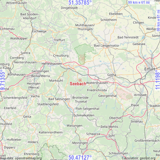
Seebach GPS coordinates[2]
50° 55' 0.012" North, 10° 25' 0.012" East
| Map corner | latitude | longitude |
|---|---|---|
| Upper-left | 51.35785°, | 9.71355° |
| Center: | 50.91667°, | 10.41667° |
| Lower-right: | 50.47127°, | 11.1198° |
| Map W x H: | 98.6×98.6 km | = 61.3×61.3mi |
| max Lat: | 55.01917° ⇑43.6% North |
| Seebach: | 50.91667° |
| min Lat: | ⇓56.4% South 47.40724° |
| min Long | Seebach | max Long |
| 5.92978° | 10.41667° | 14.98853° |
| W 57.3%⇐ | ⇒42.7% E |
Elevation
Elevation of Seebach is 332 m = 1089 ft, and this is 82.9 m = 272 ft above average elevation for this country.
| Max E: |
1256 m = 4121 ft | 33.5% |
| Seebach | 332 m 1089 ft | |
| Avg. | 249.1 m = 817 ft | |
Min E: |
-5 m = -16 ft | 66.5% |
See also: Germany elevation on elevation.city.
Geographical zone
Seebach is located in North temperate zone (between Tropic of Cancer and the Arctic Circle). Distance of this North polar circle is 1739.8 km =1081.1 mi to North.| Distance of | km | miles | from Seebach |
|---|---|---|---|
| North Pole | 4345.7 | 2700.3 | to North |
| Arctic Circle | 1739.8 | 1081.1 | to North |
| Tropic Cancer | 3055.5 | 1898.6 | to South |
| Equator | 5661.4 | 3517.8 | to South |


Nearby cities:
15 places around Seebach: (largest is in red/bold)
• Bad Liebenstein
12.1 km =7.5 mi,  202°
202°
• Brotterode
10.5 km =6.5 mi,  169°
169°
• Eisenach
10.1 km =6.3 mi,  315°
315°
• Friedrichroda
12.3 km =7.6 mi,  122°
122°
• Haina
10.8 km =6.7 mi,  41°
41°
• Hörselgau
11.8 km =7.3 mi,  88°
88°
• Laucha
8.9 km =5.5 mi,  83°
83°
• Mechterstädt
8 km =5 mi,  69°
69°
• Ruhla
4.4 km =2.7 mi,  233°
233°
• Schweina
11.6 km =7.2 mi,  208°
208°
• Steinbach
10 km =6.2 mi, 201°
• Tabarz
8.4 km =5.2 mi, 123°
• Thal
1.7 km =1.1 mi,  270°
270°
• Waltershausen
10.1 km =6.3 mi,  101°
101°
• Wolfsburg-Unkeroda
10.7 km =6.6 mi,  279°
279°
Sources, notices
• [Note1] Compared only with cities in Germany existing in our database
• [Src1] Map data: © OpenStreetMap contributors (CC-BY-SA)
• [Src2] Other city data from geonames.org with taken over terms of usage.
• [Src3] Geographical zone / Annual Mean Temperature by Robert A. Rohde @ Wikipedia
