Ruhla geodata
Ruhla (Thuringia) is a populated place; located in Germany in Europe/Berlin (GMT+2) time zone. With population of 6,757 people, there are 2246 cities with bigger population in this country. Compared to other cities in Germany, 55.9% of cities are located further ↓South; 56.6% of cities are located further ←West and 77.9% of cities have lower elevation than Ruhla. Note1


Ruhla GPS coordinates[2]
50° 53' 34.656" North, 10° 21' 56.628" East
| Map corner | latitude | longitude |
|---|---|---|
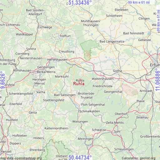
| Upper-left | 51.33436°, | 9.6626° |
| Center: | 50.89296°, | 10.36573° |
| Lower-right: | 50.44734°, | 11.06886° |
| Map W x H: | 98.6×98.6 km | = 61.3×61.3mi |
| max Lat: | 55.01917° ⇑44.1% North |
| Ruhla: | 50.89296° |
| min Lat: | ⇓55.9% South 47.40724° |
| min Long | Ruhla | max Long |
| 5.92978° | 10.36573° | 14.98853° |
| W 56.6%⇐ | ⇒43.4% E |
Elevation
Elevation of Ruhla is 418 m = 1371 ft, and this is 168.9 m = 554 ft above average elevation for this country.
| Max E: |
1256 m = 4121 ft | 22.1% |
| Ruhla | 418 m 1371 ft | |
| Avg. | 249.1 m = 817 ft | |
Min E: |
-5 m = -16 ft | 77.9% |
See also: Germany elevation on elevation.city.
Geographical zone
Ruhla is located in North temperate zone (between Tropic of Cancer and the Arctic Circle). Distance of this North polar circle is 1742.4 km =1082.7 mi to North.| Distance of | km | miles | from Ruhla |
|---|---|---|---|
| North Pole | 4348.3 | 2701.9 | to North |
| Arctic Circle | 1742.4 | 1082.7 | to North |
| Tropic Cancer | 3052.8 | 1896.9 | to South |
| Equator | 5658.8 | 3516.2 | to South |


Nearby cities:
15 places around Ruhla: (largest is in red/bold)
• Bad Liebenstein
8.7 km =5.4 mi,  186°
186°
• Bad Salzungen
12.7 km =7.9 mi,  225°
225°
• Barchfeld
11.3 km =7 mi,  204°
204°
• Brotterode
9.4 km =5.8 mi,  144°
144°
• Eisenach
10.4 km =6.5 mi,  340°
340°
• Ettenhausen
9.5 km =5.9 mi,  261°
261°
• Marksuhl
11.9 km =7.4 mi,  282°
282°
• Mechterstädt
12.3 km =7.6 mi,  63°
63°
• Schweina
7.8 km =4.8 mi, 194°
• Seebach
4.4 km =2.7 mi,  53°
53°
• Steinbach
6.6 km =4.1 mi,  181°
181°
• Tabarz
10.7 km =6.6 mi,  100°
100°
• Thal
3.2 km =2 mi,  34°
34°
• Trusetal
12.7 km =7.9 mi,  163°
163°
• Wolfsburg-Unkeroda
8.3 km =5.2 mi,  302°
302°
Sources, notices
• [Note1] Compared only with cities in Germany existing in our database
• [Src1] Map data: © OpenStreetMap contributors (CC-BY-SA)
• [Src2] Other city data from geonames.org with taken over terms of usage.
• [Src3] Geographical zone / Annual Mean Temperature by Robert A. Rohde @ Wikipedia
