Wolfsburg-Unkeroda geodata
Wolfsburg-Unkeroda (Thuringia) is a seat of a fourth-order administrative division; located in Germany in Europe/Berlin (GMT+2) time zone. With population of 778 people, there are 7993 cities with bigger population in this country. Compared to other cities in Germany, 56.8% of cities are located further ↓South; 54.6% of cities are located further ←West and 63.4% of cities have lower elevation than Wolfsburg-Unkeroda. Note1


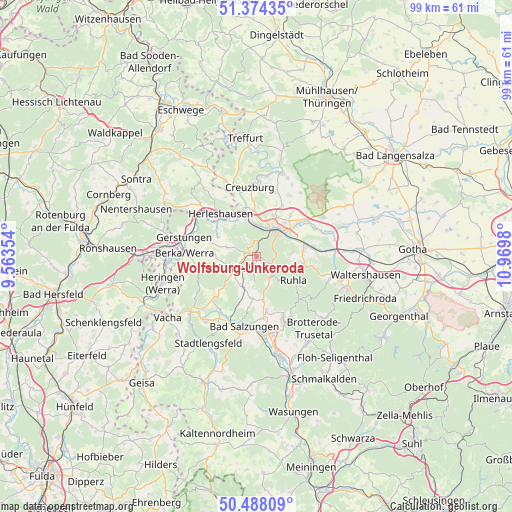
Wolfsburg-Unkeroda GPS coordinates[2]
50° 55' 59.988" North, 10° 16' 0.012" East
| Map corner | latitude | longitude |
|---|---|---|
| Upper-left | 51.37435°, | 9.56354° |
| Center: | 50.93333°, | 10.26667° |
| Lower-right: | 50.48809°, | 10.9698° |
| Map W x H: | 98.5×98.5 km | = 61.2×61.2mi |
| max Lat: | 55.01917° ⇑43.2% North |
| Wolfsburg-Unkeroda: | 50.93333° |
| min Lat: | ⇓56.8% South 47.40724° |
| min Long | Wolfsburg-Unker | max Long |
| 5.92978° | 10.26667° | 14.98853° |
| W 54.6%⇐ | ⇒45.4% E |
Elevation
Elevation of Wolfsburg-Unkeroda is 311 m = 1020 ft, and this is 61.9 m = 203 ft above average elevation for this country.
| Max E: |
1256 m = 4121 ft | 36.6% |
| Wolfsburg-Unkeroda | 311 m 1020 ft | |
| Avg. | 249.1 m = 817 ft | |
Min E: |
-5 m = -16 ft | 63.4% |
See also: Germany elevation on elevation.city.
Geographical zone
Wolfsburg-Unkeroda is located in North temperate zone (between Tropic of Cancer and the Arctic Circle). Distance of this North polar circle is 1737.9 km =1079.9 mi to North.| Distance of | km | miles | from Wolfsburg-Unkeroda |
|---|---|---|---|
| North Pole | 4343.8 | 2699.1 | to North |
| Arctic Circle | 1737.9 | 1079.9 | to North |
| Tropic Cancer | 3057.3 | 1899.7 | to South |
| Equator | 5663.3 | 3519 | to South |


Nearby cities:
15 places around Wolfsburg-Unkeroda: (largest is in red/bold)
• Eisenach
6.3 km =3.9 mi,  32°
32°
• Ettenhausen
6.4 km =4 mi,  202°
202°
• Frauensee
10.7 km =6.6 mi,  234°
234°
• Herleshausen
10.7 km =6.6 mi,  319°
319°
• Krauthausen
9.3 km =5.8 mi,  0°
0°
• Lauchröden
10.2 km =6.3 mi,  311°
311°
• Marksuhl
5 km =3.1 mi,  248°
248°
• Oberellen
5.9 km =3.7 mi,  286°
286°
• Ruhla
8.3 km =5.2 mi,  122°
122°
• Schweina
13 km =8.1 mi,  157°
157°
• Seebach
10.7 km =6.6 mi,  99°
99°
• Steinbach
13.1 km =8.1 mi,  148°
148°
• Thal
9 km =5.6 mi, 101°
• Tiefenort
12.6 km =7.8 mi,  214°
214°
• Unterellen
8.3 km =5.2 mi,  296°
296°
Sources, notices
• [Note1] Compared only with cities in Germany existing in our database
• [Src1] Map data: © OpenStreetMap contributors (CC-BY-SA)
• [Src2] Other city data from geonames.org with taken over terms of usage.
• [Src3] Geographical zone / Annual Mean Temperature by Robert A. Rohde @ Wikipedia
