Malschwitz geodata
Malschwitz (Saxony) is a seat of a fourth-order administrative division; located in Germany in Europe/Berlin (GMT+2) time zone. With population of 3,800 people, there are 3404 cities with bigger population in this country. Compared to other cities in Germany, 62.1% of cities are located further ↓South; 99.3% of cities are located further ←West and 60.4% of cities have higher elevation than Malschwitz. Note1


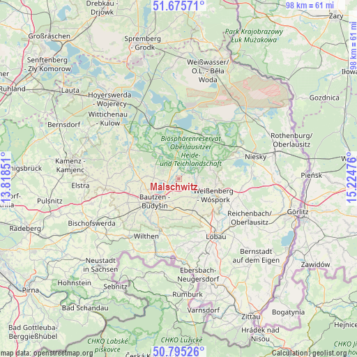
Malschwitz GPS coordinates[2]
51° 14' 15.324" North, 14° 31' 17.868" East
| Map corner | latitude | longitude |
|---|---|---|
| Upper-left | 51.67571°, | 13.81851° |
| Center: | 51.23759°, | 14.52163° |
| Lower-right: | 50.79526°, | 15.22476° |
| Map W x H: | 97.9×97.9 km | = 60.8×60.8mi |
| max Lat: | 55.01917° ⇑37.9% North |
| Malschwitz: | 51.23759° |
| min Lat: | ⇓62.1% South 47.40724° |
| min Long | Malschwitz | max Long |
| 5.92978° | 14.52163° | 14.98853° |
| W 99.3%⇐ | ⇒0.7% E |
Elevation
Elevation of Malschwitz is 149 m = 489 ft, and this is 100.1 m = 328 ft below average elevation for this country.
| Max E: |
1256 m = 4121 ft | 60.4% |
| Avg. | 249.1 m = 817 ft | |
| Malschwitz | 149 m = 489 ft | |
Min E: |
-5 m = -16 ft | 39.6% |
See also: Germany elevation on elevation.city.
Geographical zone
Malschwitz is located in North temperate zone (between Tropic of Cancer and the Arctic Circle). Distance of this North polar circle is 1704.1 km =1058.9 mi to North.| Distance of | km | miles | from Malschwitz |
|---|---|---|---|
| North Pole | 4310 | 2678.1 | to North |
| Arctic Circle | 1704.1 | 1058.9 | to North |
| Tropic Cancer | 3091.2 | 1920.8 | to South |
| Equator | 5697.1 | 3540 | to South |


Nearby cities:
15 places around Malschwitz: (largest is in red/bold)
• Bautzen
8.8 km =5.5 mi,  223°
223°
• Cunewalde
15.3 km =9.5 mi,  181°
181°
• Großdubrau
4.7 km =2.9 mi,  292°
292°
• Großpostwitz
14.2 km =8.8 mi,  203°
203°
• Guttau
3.6 km =2.2 mi,  49°
49°
• Hochkirch
10.4 km =6.5 mi,  160°
160°
• Klitten
13.9 km =8.6 mi,  24°
24°
• Kubschütz
8 km =5 mi,  190°
190°
• Mücka
15.2 km =9.4 mi, 54°
• Neschwitz
13.9 km =8.6 mi, 285°
• Obergurig
14.2 km =8.8 mi,  214°
214°
• Puschwitz
15.5 km =9.6 mi,  277°
277°
• Radibor
8.6 km =5.3 mi, 275°
• Uhyst
14.2 km =8.8 mi,  355°
355°
• Weißenberg
10.6 km =6.6 mi,  115°
115°
Sources, notices
• [Note1] Compared only with cities in Germany existing in our database
• [Src1] Map data: © OpenStreetMap contributors (CC-BY-SA)
• [Src2] Other city data from geonames.org with taken over terms of usage.
• [Src3] Geographical zone / Annual Mean Temperature by Robert A. Rohde @ Wikipedia
