Lengdorf geodata
Lengdorf (Bavaria) is a seat of a fourth-order administrative division; located in Germany in Europe/Berlin (GMT+2) time zone. With population of 2,648 people, there are 4287 cities with bigger population in this country. Compared to other cities in Germany, 91.8% of cities are located further ↑North; 82.4% of cities are located further ←West and 84.9% of cities have lower elevation than Lengdorf. Note1
Administrative division(s):
- Level 1: Bavaria
- Level 2: Upper Bavaria
- Level 3: Landkreis Erding
- Level 4: Lengdorf


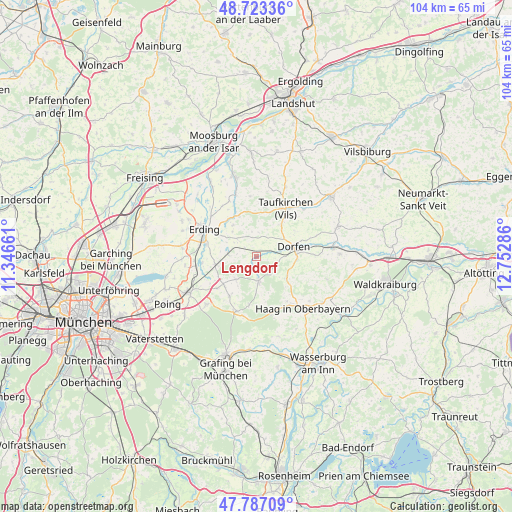
Lengdorf GPS coordinates[2]
48° 15' 26.532" North, 12° 2' 59.028" East
| Map corner | latitude | longitude |
|---|---|---|
| Upper-left | 48.72336°, | 11.34661° |
| Center: | 48.25737°, | 12.04973° |
| Lower-right: | 47.78709°, | 12.75286° |
| Map W x H: | 104.1×104.1 km | = 64.7×64.7mi |
| max Lat: | 55.01917° ⇑91.8% North |
| Lengdorf: | 48.25737° |
| min Lat: | ⇓8.2% South 47.40724° |
| min Long | Lengdorf | max Long |
| 5.92978° | 12.04973° | 14.98853° |
| W 82.4%⇐ | ⇒17.6% E |
Elevation
Elevation of Lengdorf is 468 m = 1535 ft, and this is 218.9 m = 718 ft above average elevation for this country.
| Max E: |
1256 m = 4121 ft | 15.1% |
| Lengdorf | 468 m 1535 ft | |
| Avg. | 249.1 m = 817 ft | |
Min E: |
-5 m = -16 ft | 84.9% |
See also: Germany elevation on elevation.city.
Geographical zone
Lengdorf is located in North temperate zone (between Tropic of Cancer and the Arctic Circle). Distance of this North polar circle is 2035.5 km =1264.8 mi to North.| Distance of | km | miles | from Lengdorf |
|---|---|---|---|
| North Pole | 4641.3 | 2884 | to North |
| Arctic Circle | 2035.5 | 1264.8 | to North |
| Tropic Cancer | 2759.8 | 1714.9 | to South |
| Equator | 5365.7 | 3334.1 | to South |


Nearby cities:
15 places around Lengdorf: (largest is in red/bold)
• Bockhorn
7.9 km =4.9 mi,  323°
323°
• Buch am Buchrain
6.2 km =3.9 mi,  220°
220°
• Dorfen
8.3 km =5.2 mi,  80°
80°
• Erding
11.9 km =7.4 mi,  297°
297°
• Forstern
9.8 km =6.1 mi,  213°
213°
• Fraunberg
12.7 km =7.9 mi,  343°
343°
• Hohenlinden
12 km =7.5 mi,  199°
199°
• Inning am Holz
10.1 km =6.3 mi,  10°
10°
• Isen
5.1 km =3.2 mi,  174°
174°
• Maitenbeth
12.3 km =7.6 mi,  164°
164°
• Pastetten
10.2 km =6.3 mi,  230°
230°
• Sankt Wolfgang
7.7 km =4.8 mi,  126°
126°
• Taufkirchen
12 km =7.5 mi,  30°
30°
• Walpertskirchen
5.5 km =3.4 mi,  271°
271°
• Wörth
11 km =6.8 mi,  263°
263°
Sources, notices
• [Note1] Compared only with cities in Germany existing in our database
• [Src1] Map data: © OpenStreetMap contributors (CC-BY-SA)
• [Src2] Other city data from geonames.org with taken over terms of usage.
• [Src3] Geographical zone / Annual Mean Temperature by Robert A. Rohde @ Wikipedia
