Herleshausen geodata
Herleshausen (Hesse) is a seat of a fourth-order administrative division; located in Germany in Europe/Berlin (GMT+2) time zone. With population of 3,189 people, there are 3834 cities with bigger population in this country. Compared to other cities in Germany, 58.3% of cities are located further ↓South; 52.9% of cities are located further ←West and 50.9% of cities have higher elevation than Herleshausen. Note1
Administrative division(s):
- Level 1: Hesse
- Level 2: Regierungsbezirk Kassel
- Level 3: Werra-Meißner-Kreis
- Level 4: Herleshausen


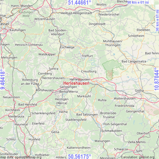
Herleshausen GPS coordinates[2]
51° 0' 22.644" North, 10° 10' 2.316" East
| Map corner | latitude | longitude |
|---|---|---|
| Upper-left | 51.44661°, | 9.46418° |
| Center: | 51.00629°, | 10.16731° |
| Lower-right: | 50.56175°, | 10.87044° |
| Map W x H: | 98.4×98.4 km | = 61.1×61.1mi |
| max Lat: | 55.01917° ⇑41.7% North |
| Herleshausen: | 51.00629° |
| min Lat: | ⇓58.3% South 47.40724° |
| min Long | Herleshausen | max Long |
| 5.92978° | 10.16731° | 14.98853° |
| W 52.9%⇐ | ⇒47.1% E |
Elevation
Elevation of Herleshausen is 219 m = 719 ft, and this is 30.1 m = 99 ft below average elevation for this country.
| Max E: |
1256 m = 4121 ft | 50.9% |
| Avg. | 249.1 m = 817 ft | |
| Herleshausen | 219 m = 719 ft | |
Min E: |
-5 m = -16 ft | 49.1% |
See also: Germany elevation on elevation.city.
Geographical zone
Herleshausen is located in North temperate zone (between Tropic of Cancer and the Arctic Circle). Distance of this North polar circle is 1729.8 km =1074.8 mi to North.| Distance of | km | miles | from Herleshausen |
|---|---|---|---|
| North Pole | 4335.7 | 2694.1 | to North |
| Arctic Circle | 1729.8 | 1074.8 | to North |
| Tropic Cancer | 3065.4 | 1904.8 | to South |
| Equator | 5671.4 | 3524 | to South |


Nearby cities:
15 places around Herleshausen: (largest is in red/bold)
• Creuzburg
7.6 km =4.7 mi,  47°
47°
• Dippach
13 km =8.1 mi,  222°
222°
• Ebenshausen
12.6 km =7.8 mi, 47°
• Eisenach
10.7 km =6.6 mi,  105°
105°
• Frankenroda
13.2 km =8.2 mi,  37°
37°
• Gerstungen
8.3 km =5.2 mi,  237°
237°
• Ifta
6.8 km =4.2 mi,  9°
9°
• Krauthausen
7 km =4.3 mi,  80°
80°
• Lauchröden
1.6 km =1 mi,  207°
207°
• Marksuhl
10.2 km =6.3 mi,  167°
167°
• Mihla
13.9 km =8.6 mi,  55°
55°
• Oberellen
6.5 km =4 mi, 168°
• Unterellen
4.5 km =2.8 mi,  186°
186°
• Weißenborn
13.7 km =8.5 mi,  344°
344°
• Wolfsburg-Unkeroda
10.7 km =6.6 mi,  139°
139°
Sources, notices
• [Note1] Compared only with cities in Germany existing in our database
• [Src1] Map data: © OpenStreetMap contributors (CC-BY-SA)
• [Src2] Other city data from geonames.org with taken over terms of usage.
• [Src3] Geographical zone / Annual Mean Temperature by Robert A. Rohde @ Wikipedia
