Lauchröden geodata
Lauchröden (Thuringia) is a populated place; located in Germany in Europe/Berlin (GMT+2) time zone. With population of 1,028 people, there are 7083 cities with bigger population in this country. Compared to other cities in Germany, 58% of cities are located further ↓South; 52.6% of cities are located further ←West and 52.9% of cities have higher elevation than Lauchröden. Note1


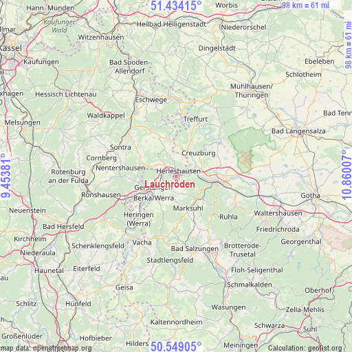
Lauchröden GPS coordinates[2]
50° 59' 37.356" North, 10° 9' 24.984" East
| Map corner | latitude | longitude |
|---|---|---|
| Upper-left | 51.43415°, | 9.45381° |
| Center: | 50.99371°, | 10.15694° |
| Lower-right: | 50.54905°, | 10.86007° |
| Map W x H: | 98.4×98.4 km | = 61.1×61.1mi |
| max Lat: | 55.01917° ⇑42% North |
| Lauchröden: | 50.99371° |
| min Lat: | ⇓58% South 47.40724° |
| min Long | Lauchröden | max Long |
| 5.92978° | 10.15694° | 14.98853° |
| W 52.6%⇐ | ⇒47.4% E |
Elevation
Elevation of Lauchröden is 205 m = 673 ft, and this is 44.1 m = 145 ft below average elevation for this country.
| Max E: |
1256 m = 4121 ft | 52.9% |
| Avg. | 249.1 m = 817 ft | |
| Lauchröden | 205 m = 673 ft | |
Min E: |
-5 m = -16 ft | 47.1% |
See also: Germany elevation on elevation.city.
Geographical zone
Lauchröden is located in North temperate zone (between Tropic of Cancer and the Arctic Circle). Distance of this North polar circle is 1731.2 km =1075.7 mi to North.| Distance of | km | miles | from Lauchröden |
|---|---|---|---|
| North Pole | 4337.1 | 2694.9 | to North |
| Arctic Circle | 1731.2 | 1075.7 | to North |
| Tropic Cancer | 3064.1 | 1903.9 | to South |
| Equator | 5670 | 3523.2 | to South |


Nearby cities:
15 places around Lauchröden: (largest is in red/bold)
• Creuzburg
9.1 km =5.7 mi,  43°
43°
• Dankmarshausen
12.5 km =7.8 mi,  232°
232°
• Dippach
11.5 km =7.1 mi,  224°
224°
• Ebenshausen
14.1 km =8.8 mi,  45°
45°
• Eisenach
11.2 km =7 mi,  97°
97°
• Ettenhausen
13.7 km =8.5 mi,  157°
157°
• Frauensee
12.9 km =8 mi,  184°
184°
• Gerstungen
7 km =4.3 mi,  244°
244°
• Herleshausen
1.6 km =1 mi,  27°
27°
• Ifta
8.3 km =5.2 mi,  12°
12°
• Krauthausen
8.1 km =5 mi,  71°
71°
• Marksuhl
9.1 km =5.7 mi, 160°
• Oberellen
5.4 km =3.4 mi, 158°
• Unterellen
3 km =1.9 mi, 175°
• Wolfsburg-Unkeroda
10.2 km =6.3 mi,  131°
131°
Sources, notices
• [Note1] Compared only with cities in Germany existing in our database
• [Src1] Map data: © OpenStreetMap contributors (CC-BY-SA)
• [Src2] Other city data from geonames.org with taken over terms of usage.
• [Src3] Geographical zone / Annual Mean Temperature by Robert A. Rohde @ Wikipedia
