Arnstein geodata
Arnstein (Bavaria) is a populated place; located in Germany in Europe/Berlin (GMT+2) time zone. With population of 8,409 people, there are 1889 cities with bigger population in this country. Compared to other cities in Germany, 64.4% of cities are located further ↑North; 50.5% of cities are located further →East and 50.5% of cities have higher elevation than Arnstein. Note1
Administrative division(s):
- Level 1: Bavaria
- Level 2: Regierungsbezirk Unterfranken
- Level 3: Landkreis Main-Spessart
- Level 4: Arnstein


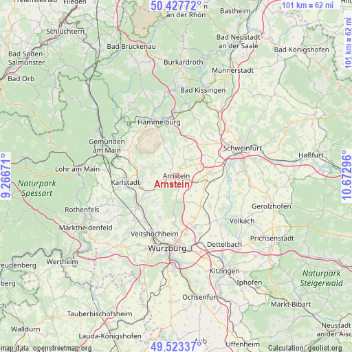
Arnstein GPS coordinates[2]
49° 58' 39.612" North, 9° 58' 11.388" East
| Map corner | latitude | longitude |
|---|---|---|
| Upper-left | 50.42772°, | 9.26671° |
| Center: | 49.97767°, | 9.96983° |
| Lower-right: | 49.52337°, | 10.67296° |
| Map W x H: | 100.6×100.6 km | = 62.5×62.5mi |
| max Lat: | 55.01917° ⇑64.4% North |
| Arnstein: | 49.97767° |
| min Lat: | ⇓35.6% South 47.40724° |
| min Long | Arnstein | max Long |
| 5.92978° | 9.96983° | 14.98853° |
| W 49.5%⇐ | ⇒50.5% E |
Elevation
Elevation of Arnstein is 221 m = 725 ft, and this is 28.1 m = 92 ft below average elevation for this country.
| Max E: |
1256 m = 4121 ft | 50.5% |
| Avg. | 249.1 m = 817 ft | |
| Arnstein | 221 m = 725 ft | |
Min E: |
-5 m = -16 ft | 49.5% |
See also: Germany elevation on elevation.city.
Geographical zone
Arnstein is located in North temperate zone (between Tropic of Cancer and the Arctic Circle). Distance of this North polar circle is 1844.2 km =1145.9 mi to North.| Distance of | km | miles | from Arnstein |
|---|---|---|---|
| North Pole | 4450.1 | 2765.2 | to North |
| Arctic Circle | 1844.2 | 1145.9 | to North |
| Tropic Cancer | 2951.1 | 1833.7 | to South |
| Equator | 5557 | 3453 | to South |


Nearby cities:
15 places around Arnstein: (largest is in red/bold)
• Bergtheim
11.1 km =6.9 mi,  141°
141°
• Eußenheim
11.5 km =7.1 mi,  274°
274°
• Gössenheim
14 km =8.7 mi,  288°
288°
• Güntersleben
12.9 km =8 mi,  201°
201°
• Himmelstadt
13.4 km =8.3 mi,  243°
243°
• Oberpleichfeld
14 km =8.7 mi, 143°
• Retzstadt
9.6 km =6 mi,  220°
220°
• Rimpar
13.5 km =8.4 mi,  183°
183°
• Schwanfeld
13.6 km =8.5 mi,  117°
117°
• Thüngen
8.9 km =5.5 mi, 243°
• Thüngersheim
14 km =8.7 mi, 218°
• Unterpleichfeld
13.2 km =8.2 mi,  156°
156°
• Waigolshausen
10.8 km =6.7 mi,  97°
97°
• Wasserlosen
13.7 km =8.5 mi,  18°
18°
• Werneck
9.2 km =5.7 mi,  87°
87°
Sources, notices
• [Note1] Compared only with cities in Germany existing in our database
• [Src1] Map data: © OpenStreetMap contributors (CC-BY-SA)
• [Src2] Other city data from geonames.org with taken over terms of usage.
• [Src3] Geographical zone / Annual Mean Temperature by Robert A. Rohde @ Wikipedia
