Mai-Mne geodata
Mai-Mne (Debub) is a seat of a second-order administrative division; located in Eritrea in Africa/Asmara (GMT+3) time zone. In our database, there are 12 cities with bigger population. Compared to other cities in Eritrea, 83.3% of cities are located further ↑North; 66.7% of cities are located further →East and 58.3% of cities have lower elevation than Mai-Mne. Note1


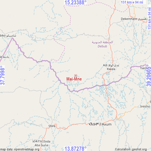
Mai-Mne GPS coordinates[2]
14° 33' 15.768" North, 38° 30' 10.512" East
| Map corner | latitude | longitude |
|---|---|---|
| Upper-left | 15.23388°, | 37.7998° |
| Center: | 14.55438°, | 38.50292° |
| Lower-right: | 13.87278°, | 39.20605° |
| Map W x H: | 151.3×151.3 km | = 94×94mi |
| max Lat: | 15.77792° ⇑83.3% North |
| Mai-Mne: | 14.55438° |
| min Lat: | ⇓16.7% South 13.00917° |
| min Long | Mai-Mne | max Long |
| 36.6575° | 38.50292° | 42.73944° |
| W 33.3%⇐ | ⇒66.7% E |
Elevation
Elevation of Mai-Mne is 1849 m = 6066 ft, and this is 560.5 m = 1839 ft above average elevation for this country.
| Max E: |
2528 m = 8294 ft | 41.7% |
| Mai-Mne | 1849 m 6066 ft | |
| Avg. | 1288.5 m = 4227 ft | |
Min E: |
7 m = 23 ft | 58.3% |
See also: Eritrea elevation on elevation.city.
Geographical zone
Mai-Mne is located in North Torrid zone (between Equator and Tropic of Cancer). Distance of this Northern Tropic circle is 987.6 km =613.7 mi to North.| Distance of | km | miles | from Mai-Mne |
|---|---|---|---|
| North Pole | 8388.8 | 5212.6 | to North |
| Arctic Circle | 5782.9 | 3593.3 | to North |
| Tropic Cancer | 987.6 | 613.7 | to North |
| Equator | 1618.3 | 1005.6 | to South |


Nearby cities:
11 places around Mai-Mne: (largest is in red/bold)
• Adi Keyh
99.4 km =61.8 mi,  71°
71°
• Ak’ordat
129 km =80.2 mi,  328°
328°
• Asmara
98.6 km =61.3 mi,  27°
27°
• Barentu
115.6 km =71.8 mi,  302°
302°
• Dek’emhāre
81.9 km =50.9 mi,  45°
45°
• Edd
350.8 km =218 mi,  101°
101°
• Keren
136.2 km =84.6 mi,  357°
357°
• Massawa
156.9 km =97.5 mi,  41°
41°
• Mendefera
50 km =31.1 mi, 42°
• Quandeba
113.6 km =70.6 mi,  20°
20°
• Teseney
207.8 km =129.1 mi,  287°
287°
Sources, notices
• [Note1] Compared only with cities in Eritrea existing in our database
• [Src1] Map data: © OpenStreetMap contributors (CC-BY-SA)
• [Src2] Other city data from geonames.org with taken over terms of usage.
• [Src3] Geographical zone / Annual Mean Temperature by Robert A. Rohde @ Wikipedia
