Teseney geodata
Teseney (Gash-Barka) is a section of populated place; located in Eritrea in Africa/Asmara (GMT+3) time zone. With population of 3,753 people, there are 10 cities with bigger population in this country. Compared to other cities in Eritrea, 58.3% of cities are located further ↓South; 100% of cities are located further →East and 75% of cities have higher elevation than Teseney. Note1


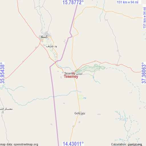
Teseney GPS coordinates[2]
15° 6' 36" North, 36° 39' 27" East
| Map corner | latitude | longitude |
|---|---|---|
| Upper-left | 15.78772°, | 35.95438° |
| Center: | 15.11°, | 36.6575° |
| Lower-right: | 14.43011°, | 37.36063° |
| Map W x H: | 151×151 km | = 93.8×93.8mi |
| max Lat: | 15.77792° ⇑41.7% North |
| Teseney: | 15.11° |
| min Lat: | ⇓58.3% South 13.00917° |
| min Long | Teseney | max Long |
| 36.6575° | 36.6575° | 42.73944° |
| W 0%⇐ | ⇒100% E |
Elevation
Elevation of Teseney is 594 m = 1949 ft, and this is 694.5 m = 2279 ft below average elevation for this country.
| Max E: |
2528 m = 8294 ft | 75% |
| Avg. | 1288.5 m = 4227 ft | |
| Teseney | 594 m = 1949 ft | |
Min E: |
7 m = 23 ft | 25% |
See also: Eritrea elevation on elevation.city.
Geographical zone
Teseney is located in North Torrid zone (between Equator and Tropic of Cancer). Distance of this Northern Tropic circle is 925.8 km =575.3 mi to North.| Distance of | km | miles | from Teseney |
|---|---|---|---|
| North Pole | 8327 | 5174.2 | to North |
| Arctic Circle | 5721.1 | 3554.9 | to North |
| Tropic Cancer | 925.8 | 575.3 | to North |
| Equator | 1680.1 | 1044 | to South |


Nearby cities:
10 places around Teseney: (largest is in red/bold)
• Adi Keyh
293.6 km =182.4 mi,  95°
95°
• Ak’ordat
140.1 km =87.1 mi,  69°
69°
• Asmara
245.3 km =152.4 mi,  84°
84°
• Barentu
100.2 km =62.3 mi,  90°
90°
• Dek’emhāre
256.6 km =159.4 mi, 90°
• Keren
206.1 km =128.1 mi, 68°
• Mai-Mne
207.8 km =129.1 mi,  107°
107°
• Massawa
307.1 km =190.8 mi, 79°
• Mendefera
233.1 km =144.8 mi, 96°
• Quandeba
242.3 km =150.6 mi, 79°
Sources, notices
• [Note1] Compared only with cities in Eritrea existing in our database
• [Src1] Map data: © OpenStreetMap contributors (CC-BY-SA)
• [Src2] Other city data from geonames.org with taken over terms of usage.
• [Src3] Geographical zone / Annual Mean Temperature by Robert A. Rohde @ Wikipedia
