Keren geodata
Keren (Anseba) is a seat of a first-order administrative division; located in Eritrea in Africa/Asmara (GMT+3) time zone. With population of 74,800 people, there is 1 city with bigger population in this country. Compared to other cities in Eritrea, 100% of cities are located further ↓South; 75% of cities are located further →East and 50% of cities have lower elevation than Keren. Note1


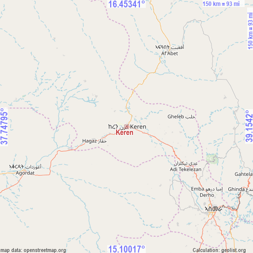
Keren GPS coordinates[2]
15° 46' 40.512" North, 38° 27' 3.852" East
| Map corner | latitude | longitude |
|---|---|---|
| Upper-left | 16.45341°, | 37.74795° |
| Center: | 15.77792°, | 38.45107° |
| Lower-right: | 15.10017°, | 39.1542° |
| Map W x H: | 150.5×150.5 km | = 93.5×93.5mi |
| max Lat: | 15.77792° ⇑0% North |
| Keren: | 15.77792° |
| min Lat: | ⇓100% South 13.00917° |
| min Long | Keren | max Long |
| 36.6575° | 38.45107° | 42.73944° |
| W 25%⇐ | ⇒75% E |
Elevation
Elevation of Keren is 1399 m = 4590 ft, and this is 110.5 m = 363 ft above average elevation for this country.
| Max E: |
2528 m = 8294 ft | 50% |
| Keren | 1399 m 4590 ft | |
| Avg. | 1288.5 m = 4227 ft | |
Min E: |
7 m = 23 ft | 50% |
See also: Keren elevation on elevation.city.
Geographical zone
Keren is located in North Torrid zone (between Equator and Tropic of Cancer). Distance of this Northern Tropic circle is 851.6 km =529.2 mi to North.| Distance of | km | miles | from Keren |
|---|---|---|---|
| North Pole | 8252.7 | 5128 | to North |
| Arctic Circle | 5646.8 | 3508.8 | to North |
| Tropic Cancer | 851.6 | 529.2 | to North |
| Equator | 1754.3 | 1090.1 | to South |


Nearby cities:
11 places around Keren: (largest is in red/bold)
• Adi Keyh
143.7 km =89.3 mi,  136°
136°
• Ak’ordat
66 km =41 mi,  247°
247°
• Asmara
71 km =44.1 mi,  133°
133°
• Barentu
118.7 km =73.8 mi,  230°
230°
• Dek’emhāre
101.4 km =63 mi, 140°
• Edd
404.5 km =251.3 mi,  120°
120°
• Mai-Mne
136.2 km =84.6 mi,  177°
177°
• Massawa
111.2 km =69.1 mi,  99°
99°
• Mendefera
106.5 km =66.2 mi,  158°
158°
• Quandeba
54.6 km =33.9 mi, 123°
• Teseney
206.1 km =128.1 mi, 248°
Sources, notices
• [Note1] Compared only with cities in Eritrea existing in our database
• [Src1] Map data: © OpenStreetMap contributors (CC-BY-SA)
• [Src2] Other city data from geonames.org with taken over terms of usage.
• [Src3] Geographical zone / Annual Mean Temperature by Robert A. Rohde @ Wikipedia
