Ak’ordat geodata
Ak’ordat (Gash-Barka) is a populated place; located in Eritrea in Africa/Asmara (GMT+3) time zone. With population of 8,857 people, there are 9 cities with bigger population in this country. Compared to other cities in Eritrea, 83.3% of cities are located further ↓South; 83.3% of cities are located further →East and 66.7% of cities have higher elevation than Ak’ordat. Note1


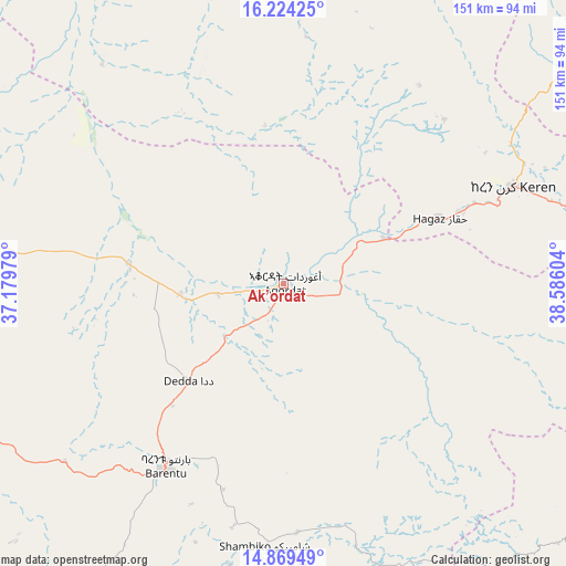
Ak’ordat GPS coordinates[2]
15° 32' 52.728" North, 37° 52' 58.476" East
| Map corner | latitude | longitude |
|---|---|---|
| Upper-left | 16.22425°, | 37.17979° |
| Center: | 15.54798°, | 37.88291° |
| Lower-right: | 14.86949°, | 38.58604° |
| Map W x H: | 150.6×150.6 km | = 93.6×93.6mi |
| max Lat: | 15.77792° ⇑16.7% North |
| Ak’ordat: | 15.54798° |
| min Lat: | ⇓83.3% South 13.00917° |
| min Long | Ak’ordat | max Long |
| 36.6575° | 37.88291° | 42.73944° |
| W 16.7%⇐ | ⇒83.3% E |
Elevation
Elevation of Ak’ordat is 612 m = 2008 ft, and this is 676.5 m = 2219 ft below average elevation for this country.
| Max E: |
2528 m = 8294 ft | 66.7% |
| Avg. | 1288.5 m = 4227 ft | |
| Ak’ordat | 612 m = 2008 ft | |
Min E: |
7 m = 23 ft | 33.3% |
See also: Eritrea elevation on elevation.city.
Geographical zone
Ak’ordat is located in North Torrid zone (between Equator and Tropic of Cancer). Distance of this Northern Tropic circle is 877.1 km =545 mi to North.| Distance of | km | miles | from Ak’ordat |
|---|---|---|---|
| North Pole | 8278.3 | 5143.9 | to North |
| Arctic Circle | 5672.4 | 3524.7 | to North |
| Tropic Cancer | 877.1 | 545 | to North |
| Equator | 1728.8 | 1074.2 | to South |


Nearby cities:
10 places around Ak’ordat: (largest is in red/bold)
• Adi Keyh
178.4 km =110.9 mi,  116°
116°
• Asmara
114.8 km =71.3 mi,  101°
101°
• Barentu
58.3 km =36.2 mi,  212°
212°
• Dek’emhāre
135.7 km =84.3 mi,  113°
113°
• Keren
66 km =41 mi,  67°
67°
• Mai-Mne
129 km =80.2 mi,  148°
148°
• Massawa
170.6 km =106 mi,  87°
87°
• Mendefera
124.1 km =77.1 mi,  126°
126°
• Quandeba
106.7 km =66.3 mi, 92°
• Teseney
140.1 km =87.1 mi,  249°
249°
Sources, notices
• [Note1] Compared only with cities in Eritrea existing in our database
• [Src1] Map data: © OpenStreetMap contributors (CC-BY-SA)
• [Src2] Other city data from geonames.org with taken over terms of usage.
• [Src3] Geographical zone / Annual Mean Temperature by Robert A. Rohde @ Wikipedia
