Caudete geodata
Caudete (Castille-La Mancha) is a seat of a third-order administrative division; located in Spain in Europe/Madrid (GMT+2) time zone. With population of 10,330 people, there are 840 cities with bigger population in this country. Compared to other cities in Spain, 84.1% of cities are located further ↑North; 77.3% of cities are located further ←West and 57.6% of cities have higher elevation than Caudete. Note1
Administrative division(s):
- Level 1: Castille-La Mancha
- Level 2: Provincia de Albacete
- Level 3: Caudete


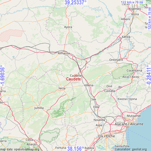
Caudete GPS coordinates[2]
38° 42' 24.444" North, 0° 59' 14.028" West
| Map corner | latitude | longitude |
|---|---|---|
| Upper-left | 39.25337°, | -1.69036° |
| Center: | 38.70679°, | -0.98723° |
| Lower-right: | 38.156°, | -0.28411° |
| Map W x H: | 122×122 km | = 75.8×75.8mi |
| max Lat: | 43.74134° ⇑84.1% North |
| Caudete: | 38.70679° |
| min Lat: | ⇓15.9% South 27.64134° |
| min Long | Caudete | max Long |
| -18.00367° | -0.98723° | 4.2899° |
| W 77.3%⇐ | ⇒22.7% E |
Elevation
Elevation of Caudete is 556 m = 1824 ft, and this is 42 m = 138 ft below average elevation for this country.
| Max E: |
1682 m = 5518 ft | 57.6% |
| Avg. | 598 m = 1962 ft | |
| Caudete | 556 m = 1824 ft | |
Min E: |
0 m = 0 ft | 42.4% |
See also: Spain elevation on elevation.city.
Geographical zone
Caudete is located in North temperate zone (between Tropic of Cancer and the Arctic Circle). Distance of this Northern Tropic circle is 1697.9 km =1055 mi to South.| Distance of | km | miles | from Caudete |
|---|---|---|---|
| North Pole | 5703.3 | 3543.9 | to North |
| Arctic Circle | 3097.4 | 1924.6 | to North |
| Tropic Cancer | 1697.9 | 1055 | to South |
| Equator | 4303.8 | 2674.3 | to South |


Nearby cities:
15 places around Caudete: (largest is in red/bold)
• Almansa
20.4 km =12.7 mi,  332°
332°
• Beneixama
19.2 km =11.9 mi,  92°
92°
• Biar
21.1 km =13.1 mi,  113°
113°
• Castalla
30 km =18.6 mi, 114°
• Cañada
15.5 km =9.6 mi,  103°
103°
• Elda
30.6 km =19 mi,  146°
146°
• Fontanars dels Alforins
19.4 km =12.1 mi,  63°
63°
• La Font de la Figuera
13.7 km =8.5 mi,  40°
40°
• Mogente
27.8 km =17.3 mi,  47°
47°
• Montealegre del Castillo
30.9 km =19.2 mi,  287°
287°
• Onil
28.7 km =17.8 mi, 108°
• Salinas
21.7 km =13.5 mi,  162°
162°
• Sax
23.9 km =14.9 mi,  142°
142°
• Villena
13.1 km =8.1 mi,  126°
126°
• Yecla
15.2 km =9.4 mi,  226°
226°
Sources, notices
• [Note1] Compared only with cities in Spain existing in our database
• [Src1] Map data: © OpenStreetMap contributors (CC-BY-SA)
• [Src2] Other city data from geonames.org with taken over terms of usage.
• [Src3] Geographical zone / Annual Mean Temperature by Robert A. Rohde @ Wikipedia
