Cárcar geodata
Cárcar (Navarre) is a seat of a third-order administrative division; located in Spain in Europe/Madrid (GMT+2) time zone. With population of 1,059 people, there are 2866 cities with bigger population in this country. Compared to other cities in Spain, 84.6% of cities are located further ↓South; 67.8% of cities are located further ←West and 68.9% of cities have higher elevation than Cárcar. Note1


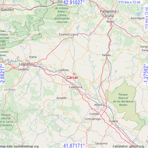
Cárcar GPS coordinates[2]
42° 23' 35.304" North, 1° 58' 44.544" West
| Map corner | latitude | longitude |
|---|---|---|
| Upper-left | 42.91027°, | -2.68217° |
| Center: | 42.39314°, | -1.97904° |
| Lower-right: | 41.87171°, | -1.27592° |
| Map W x H: | 115.5×115.5 km | = 71.8×71.8mi |
| max Lat: | 43.74134° ⇑15.4% North |
| Cárcar: | 42.39314° |
| min Lat: | ⇓84.6% South 27.64134° |
| min Long | Cárcar | max Long |
| -18.00367° | -1.97904° | 4.2899° |
| W 67.8%⇐ | ⇒32.2% E |
Elevation
Elevation of Cárcar is 401 m = 1316 ft, and this is 197 m = 646 ft below average elevation for this country.
| Max E: |
1682 m = 5518 ft | 68.9% |
| Avg. | 598 m = 1962 ft | |
| Cárcar | 401 m = 1316 ft | |
Min E: |
0 m = 0 ft | 31.1% |
See also: Spain elevation on elevation.city.
Geographical zone
Cárcar is located in North temperate zone (between Tropic of Cancer and the Arctic Circle). Distance of this Northern Tropic circle is 2107.8 km =1309.7 mi to South.| Distance of | km | miles | from Cárcar |
|---|---|---|---|
| North Pole | 5293.4 | 3289.2 | to North |
| Arctic Circle | 2687.5 | 1669.9 | to North |
| Tropic Cancer | 2107.8 | 1309.7 | to South |
| Equator | 4713.7 | 2929 | to South |


Nearby cities:
15 places around Cárcar: (largest is in red/bold)
• Alcanadre
11.7 km =7.3 mi,  276°
276°
• Andosilla
3.5 km =2.2 mi,  120°
120°
• Azagra
12.2 km =7.6 mi,  147°
147°
• Calahorra
9.9 km =6.2 mi,  173°
173°
• El Villar de Arnedo
12.5 km =7.8 mi,  229°
229°
• Falces
15.3 km =9.5 mi,  91°
91°
• Lerín
10 km =6.2 mi,  3°
3°
• Lodosa
8.7 km =5.4 mi,  292°
292°
• Miranda de Arga
16 km =9.9 mi,  51°
51°
• Peralta
15.9 km =9.9 mi,  112°
112°
• Pradejón
9.8 km =6.1 mi, 228°
• San Adrián
7.5 km =4.7 mi, 151°
• Sartaguda
6.5 km =4 mi,  260°
260°
• Sesma
12.7 km =7.9 mi,  317°
317°
• Tudelilla
15.4 km =9.6 mi, 227°
Sources, notices
• [Note1] Compared only with cities in Spain existing in our database
• [Src1] Map data: © OpenStreetMap contributors (CC-BY-SA)
• [Src2] Other city data from geonames.org with taken over terms of usage.
• [Src3] Geographical zone / Annual Mean Temperature by Robert A. Rohde @ Wikipedia
