Heuchin geodata
Heuchin (Hauts-de-France) is a populated place; located in France in Europe/Paris (GMT+1) time zone. With population of 535 people, there are 14511 cities with bigger population in this country. Compared to other cities in France, 97.1% of cities are located further ↓South; 53.2% of cities are located further →East and 65.6% of cities have higher elevation than Heuchin. Note1
Administrative division(s):
- Level 1: Hauts-de-France
- Level 2: Pas-de-Calais
- Level 3: Arras
- Level 4: Heuchin


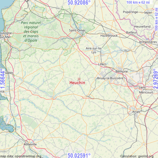
Heuchin GPS coordinates[2]
50° 28' 31.8" North, 2° 16' 10.416" East
| Map corner | latitude | longitude |
|---|---|---|
| Upper-left | 50.92086°, | 1.56644° |
| Center: | 50.4755°, | 2.26956° |
| Lower-right: | 50.02591°, | 2.97269° |
| Map W x H: | 99.5×99.5 km | = 61.8×61.8mi |
| max Lat: | 51.07786° ⇑2.9% North |
| Heuchin: | 50.4755° |
| min Lat: | ⇓97.1% South 41.3874° |
| min Long | Heuchin | max Long |
| -5.08615° | 2.26956° | 9.52242° |
| W 46.8%⇐ | ⇒53.2% E |
Elevation
Elevation of Heuchin is 88 m = 289 ft, and this is 105.7 m = 347 ft below average elevation for this country.
| Max E: |
2333 m = 7654 ft | 65.6% |
| Avg. | 193.7 m = 635 ft | |
| Heuchin | 88 m = 289 ft | |
Min E: |
-1 m = -3 ft | 34.4% |
See also: France elevation on elevation.city.
Geographical zone
Heuchin is located in North temperate zone (between Tropic of Cancer and the Arctic Circle). Distance of this North polar circle is 1788.8 km =1111.5 mi to North.| Distance of | km | miles | from Heuchin |
|---|---|---|---|
| North Pole | 4394.7 | 2730.7 | to North |
| Arctic Circle | 1788.8 | 1111.5 | to North |
| Tropic Cancer | 3006.4 | 1868.1 | to South |
| Equator | 5612.3 | 3487.3 | to South |


Nearby cities:
15 places around Heuchin: (largest is in red/bold)
• Anvin
3.4 km =2.1 mi,  198°
198°
• Blangy-sur-Ternoise
9.3 km =5.8 mi,  229°
229°
• Bomy
11.2 km =7 mi,  347°
347°
• Bours
10.2 km =6.3 mi,  103°
103°
• Enquin-les-Mines
12.5 km =7.8 mi,  4°
4°
• Febvin-Palfart
7.7 km =4.8 mi,  24°
24°
• Ferfay
12 km =7.5 mi,  66°
66°
• Floringhem
11.3 km =7 mi,  78°
78°
• Fruges
10.6 km =6.6 mi,  294°
294°
• Gauchin-Verloingt
9.3 km =5.8 mi,  161°
161°
• Ligny-lès-Aire
10.7 km =6.6 mi,  31°
31°
• Lisbourg
5.1 km =3.2 mi,  313°
313°
• Pernes
10.2 km =6.3 mi, 84°
• Saint-Pol-sur-Ternoise
11.4 km =7.1 mi, 156°
• Valhuon
9 km =5.6 mi,  121°
121°
Sources, notices
• [Note1] Compared only with cities in France existing in our database
• [Src1] Map data: © OpenStreetMap contributors (CC-BY-SA)
• [Src2] Other city data from geonames.org with taken over terms of usage.
• [Src3] Geographical zone / Annual Mean Temperature by Robert A. Rohde @ Wikipedia
