Java geodata
Java (Mtskheta-Mtianeti) is a seat of a second-order administrative division; located in Georgia in Asia/Tbilisi (GMT+4) time zone. With population of 426 people, there are 109 cities with bigger population in this country. Compared to other cities in Georgia, 75.2% of cities are located further ↓South; 67.5% of cities are located further ←West and 82.1% of cities have lower elevation than Java. Note1


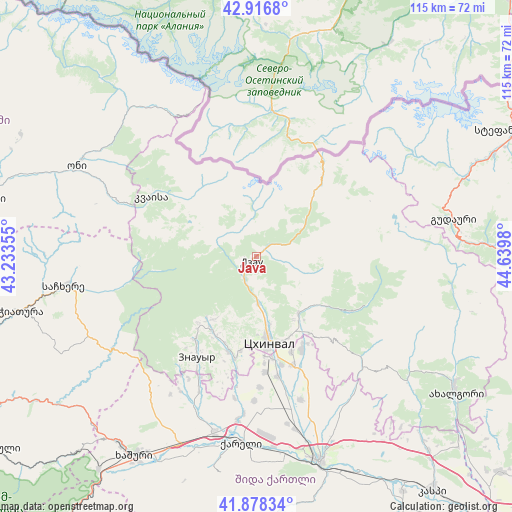
Java GPS coordinates[2]
42° 23' 58.992" North, 43° 56' 12.012" East
| Map corner | latitude | longitude |
|---|---|---|
| Upper-left | 42.9168°, | 43.23355° |
| Center: | 42.39972°, | 43.93667° |
| Lower-right: | 41.87834°, | 44.6398° |
| Map W x H: | 115.5×115.5 km | = 71.8×71.8mi |
| max Lat: | 43.38111° ⇑24.8% North |
| Java: | 42.39972° |
| min Lat: | ⇓75.2% South 41.21725° |
| min Long | Java | max Long |
| 40.07944° | 43.93667° | 46.27667° |
| W 67.5%⇐ | ⇒32.5% E |
Elevation
Elevation of Java is 1084 m = 3556 ft, and this is 505.2 m = 1657 ft above average elevation for this country.
| Max E: |
2223 m = 7293 ft | 17.9% |
| Java | 1084 m 3556 ft | |
| Avg. | 578.8 m = 1899 ft | |
Min E: |
1 m = 3 ft | 82.1% |
See also: Georgia elevation on elevation.city.
Geographical zone
Java is located in North temperate zone (between Tropic of Cancer and the Arctic Circle). Distance of this Northern Tropic circle is 2108.5 km =1310.2 mi to South.| Distance of | km | miles | from Java |
|---|---|---|---|
| North Pole | 5292.7 | 3288.7 | to North |
| Arctic Circle | 2686.8 | 1669.5 | to North |
| Tropic Cancer | 2108.5 | 1310.2 | to South |
| Equator | 4714.4 | 2929.4 | to South |


Nearby cities:
15 places around Java: (largest is in red/bold)
• Agara
41.3 km =25.7 mi,  192°
192°
• Akhalgori
54.3 km =33.7 mi,  124°
124°
• Chiat’ura
53.6 km =33.3 mi,  257°
257°
• Gori
48.5 km =30.1 mi,  162°
162°
• Gudauri
45.1 km =28 mi,  78°
78°
• Khashuri
52.9 km =32.9 mi,  211°
211°
• Khet’agurovi
21.6 km =13.4 mi, 189°
• Oni
45.2 km =28.1 mi,  296°
296°
• Sach’khere
42.9 km =26.7 mi, 261°
• Sioni
58 km =36 mi,  66°
66°
• Surami
52.2 km =32.4 mi,  216°
216°
• Tbeti
19 km =11.8 mi, 185°
• Ts’khinvali
19.3 km =12 mi,  172°
172°
• Uplistsikhe
52 km =32.3 mi, 158°
• Znaur
26.5 km =16.5 mi, 210°
Sources, notices
• [Note1] Compared only with cities in Georgia existing in our database
• [Src1] Map data: © OpenStreetMap contributors (CC-BY-SA)
• [Src2] Other city data from geonames.org with taken over terms of usage.
• [Src3] Geographical zone / Annual Mean Temperature by Robert A. Rohde @ Wikipedia
