Mampong geodata
Mampong (Ashanti) is a populated place; located in Ghana in Africa/Accra (GMT+0) time zone. With population of 42,037 people, there are 35 cities with bigger population in this country. Compared to other cities in Ghana, 72.2% of cities are located further ↓South; 66.7% of cities are located further →East and 93.1% of cities have lower elevation than Mampong. Note1


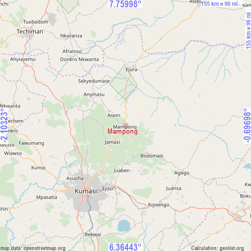
Mampong GPS coordinates[2]
7° 3' 45.828" North, 1° 24' 0.36" West
| Map corner | latitude | longitude |
|---|---|---|
| Upper-left | 7.75998°, | -2.10323° |
| Center: | 7.06273°, | -1.4001° |
| Lower-right: | 6.36443°, | -0.69698° |
| Map W x H: | 155.2×155.2 km | = 96.4×96.4mi |
| max Lat: | 11.0616° ⇑27.8% North |
| Mampong: | 7.06273° |
| min Lat: | ⇓72.2% South 4.86641° |
| min Long | Mampong | max Long |
| -2.78516° | -1.4001° | 1.19012° |
| W 33.3%⇐ | ⇒66.7% E |
Elevation
Elevation of Mampong is 395 m = 1296 ft, and this is 224.8 m = 738 ft above average elevation for this country.
| Max E: |
477 m = 1565 ft | 6.9% |
| Mampong | 395 m 1296 ft | |
| Avg. | 170.2 m = 558 ft | |
Min E: |
0 m = 0 ft | 93.1% |
See also: Mampong elevation on elevation.city.
Geographical zone
Mampong is located in North Torrid zone (between Equator and Tropic of Cancer). Distance of Equator is 785.3 km =488 mi to South.| Distance of | km | miles | from Mampong |
|---|---|---|---|
| North Pole | 9221.8 | 5730.2 | to North |
| Arctic Circle | 6615.9 | 4110.9 | to North |
| Tropic Cancer | 1820.6 | 1131.3 | to North |
| Equator | 785.3 | 488 | to South |


Nearby cities:
15 places around Mampong: (largest is in red/bold)
• Agogo
45.7 km =28.4 mi,  129°
129°
• Bechem
69 km =42.9 mi,  272°
272°
• Bekwai
70.7 km =43.9 mi,  196°
196°
• Duayaw-Nkwanta
78.2 km =48.6 mi,  279°
279°
• Ejura
36.2 km =22.5 mi,  7°
7°
• Konongo
53.6 km =33.3 mi,  157°
157°
• Kumasi
48.4 km =30.1 mi,  210°
210°
• Mamponteng
40.2 km =25 mi, 204°
• Mpraeso
90.1 km =56 mi, 125°
• Obuase
100.1 km =62.2 mi, 197°
• Odumase Krobo
87.3 km =54.2 mi, 132°
• Sunyani
106.8 km =66.4 mi,  286°
286°
• Tafo
43.7 km =27.2 mi, 212°
• Techiman
83 km =51.6 mi,  314°
314°
• Wenchi
108.1 km =67.2 mi, 314°
Sources, notices
• [Note1] Compared only with cities in Ghana existing in our database
• [Src1] Map data: © OpenStreetMap contributors (CC-BY-SA)
• [Src2] Other city data from geonames.org with taken over terms of usage.
• [Src3] Geographical zone / Annual Mean Temperature by Robert A. Rohde @ Wikipedia
