Sunyani geodata
Sunyani (Brong-Ahafo) is a seat of a first-order administrative division; located in Ghana in Africa/Accra (GMT+0) time zone. With population of 70,299 people, there are 16 cities with bigger population in this country. Compared to other cities in Ghana, 77.8% of cities are located further ↓South; 95.8% of cities are located further →East and 81.9% of cities have lower elevation than Sunyani. Note1


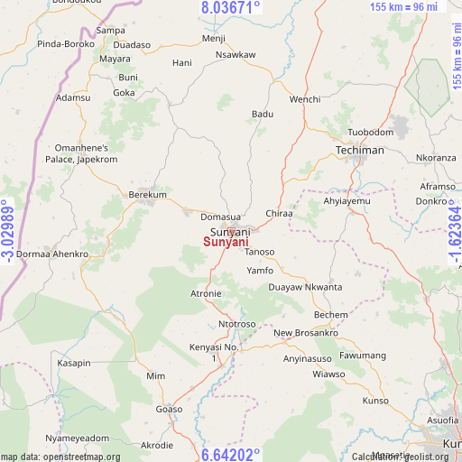
Sunyani GPS coordinates[2]
7° 20' 23.676" North, 2° 19' 36.336" West
| Map corner | latitude | longitude |
|---|---|---|
| Upper-left | 8.03671°, | -3.02989° |
| Center: | 7.33991°, | -2.32676° |
| Lower-right: | 6.64202°, | -1.62364° |
| Map W x H: | 155.1×155.1 km | = 96.4×96.4mi |
| max Lat: | 11.0616° ⇑22.2% North |
| Sunyani: | 7.33991° |
| min Lat: | ⇓77.8% South 4.86641° |
| min Long | Sunyani | max Long |
| -2.78516° | -2.32676° | 1.19012° |
| W 4.2%⇐ | ⇒95.8% E |
Elevation
Elevation of Sunyani is 298 m = 978 ft, and this is 127.8 m = 419 ft above average elevation for this country.
| Max E: |
477 m = 1565 ft | 18.1% |
| Sunyani | 298 m 978 ft | |
| Avg. | 170.2 m = 558 ft | |
Min E: |
0 m = 0 ft | 81.9% |
See also: Sunyani elevation on elevation.city.
Geographical zone
Sunyani is located in North Torrid zone (between Equator and Tropic of Cancer). Distance of Equator is 816.1 km =507.1 mi to South.| Distance of | km | miles | from Sunyani |
|---|---|---|---|
| North Pole | 9190.9 | 5711 | to North |
| Arctic Circle | 6585.1 | 4091.8 | to North |
| Tropic Cancer | 1789.8 | 1112.1 | to North |
| Equator | 816.1 | 507.1 | to South |


Nearby cities:
15 places around Sunyani: (largest is in red/bold)
• Bechem
43.3 km =26.9 mi,  129°
129°
• Bekwai
128.7 km =80 mi,  140°
140°
• Berekum
31 km =19.3 mi,  293°
293°
• Bibiani
97.5 km =60.6 mi,  179°
179°
• Duayaw-Nkwanta
31.1 km =19.3 mi, 126°
• Ejura
107.2 km =66.6 mi,  87°
87°
• Japekrom
56.9 km =35.4 mi,  297°
297°
• Kintampo
103.2 km =64.1 mi,  39°
39°
• Kumasi
106.1 km =65.9 mi, 133°
• Mampong
106.8 km =66.4 mi,  106°
106°
• Mamponteng
109.1 km =67.8 mi, 128°
• Obuase
145.9 km =90.7 mi,  150°
150°
• Tafo
103.8 km =64.5 mi, 130°
• Techiman
50.7 km =31.5 mi,  57°
57°
• Wenchi
50.7 km =31.5 mi,  28°
28°
Sources, notices
• [Note1] Compared only with cities in Ghana existing in our database
• [Src1] Map data: © OpenStreetMap contributors (CC-BY-SA)
• [Src2] Other city data from geonames.org with taken over terms of usage.
• [Src3] Geographical zone / Annual Mean Temperature by Robert A. Rohde @ Wikipedia
