Soloma geodata
Soloma (Huehuetenango) is a seat of a second-order administrative division; located in Guatemala in America/Guatemala (GMT-6) time zone. With population of 10,916 people, there are 115 cities with bigger population in this country. Compared to other cities in Guatemala, 90.9% of cities are located further ↓South; 67.6% of cities are located further →East and 85.3% of cities have lower elevation than Soloma. Note1


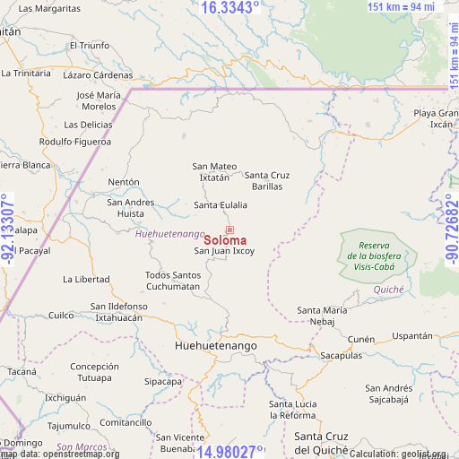
Soloma GPS coordinates[2]
15° 39' 30.276" North, 91° 25' 47.784" West
| Map corner | latitude | longitude |
|---|---|---|
| Upper-left | 16.3343°, | -92.13307° |
| Center: | 15.65841°, | -91.42994° |
| Lower-right: | 14.98027°, | -90.72682° |
| Map W x H: | 150.6×150.6 km | = 93.6×93.6mi |
| max Lat: | 17.06606° ⇑9.1% North |
| Soloma: | 15.65841° |
| min Lat: | ⇓90.9% South 13.9274° |
| min Long | Soloma | max Long |
| -92.19298° | -91.42994° | -88.59444° |
| W 32.4%⇐ | ⇒67.6% E |
Elevation
Elevation of Soloma is 2270 m = 7448 ft, and this is 1003 m = 3291 ft above average elevation for this country.
| Max E: |
3254 m = 10676 ft | 14.7% |
| Soloma | 2270 m 7448 ft | |
| Avg. | 1267 m = 4157 ft | |
Min E: |
1 m = 3 ft | 85.3% |
See also: Guatemala elevation on elevation.city.
Geographical zone
Soloma is located in North Torrid zone (between Equator and Tropic of Cancer). Distance of this Northern Tropic circle is 864.9 km =537.4 mi to North.| Distance of | km | miles | from Soloma |
|---|---|---|---|
| North Pole | 8266 | 5136.3 | to North |
| Arctic Circle | 5660.1 | 3517 | to North |
| Tropic Cancer | 864.9 | 537.4 | to North |
| Equator | 1741.1 | 1081.9 | to South |


Nearby cities:
15 places around Soloma: (largest is in red/bold)
• Barillas
20.2 km =12.6 mi,  37°
37°
• Chiantla
33.9 km =21.1 mi,  185°
185°
• Concepción Huista
25.5 km =15.8 mi,  261°
261°
• Jacaltenango
30.2 km =18.8 mi,  271°
271°
• San Antonio Huista
36.6 km =22.7 mi, 268°
• San Juan Atitán
32.9 km =20.4 mi,  219°
219°
• San Juan Ixcoy
6.7 km =4.2 mi,  195°
195°
• San Mateo Ixtatán
20 km =12.4 mi,  345°
345°
• San Miguel Acatán
18.7 km =11.6 mi,  285°
285°
• San Rafael La Independencia
12.3 km =7.6 mi, 292°
• San Sebastián Coatán
16.6 km =10.3 mi,  301°
301°
• San Sebastián Huehuetenango
36.1 km =22.4 mi,  213°
213°
• Santa Eulalia
8.6 km =5.3 mi,  339°
339°
• Santiago Chimaltenango
35 km =21.7 mi,  234°
234°
• Todos Santos Cuchumatán
25 km =15.5 mi, 228°
Sources, notices
• [Note1] Compared only with cities in Guatemala existing in our database
• [Src1] Map data: © OpenStreetMap contributors (CC-BY-SA)
• [Src2] Other city data from geonames.org with taken over terms of usage.
• [Src3] Geographical zone / Annual Mean Temperature by Robert A. Rohde @ Wikipedia
