San Rafael La Independencia geodata
San Rafael La Independencia (Huehuetenango) is a seat of a second-order administrative division; located in Guatemala in America/Guatemala (GMT-6) time zone. With population of 1,059 people, there are 311 cities with bigger population in this country. Compared to other cities in Guatemala, 91.7% of cities are located further ↓South; 75.2% of cities are located further →East and 93.8% of cities have lower elevation than San Rafael La Independencia. Note1
Current local time in San Rafael La Independencia:
03:52 PM, SundayDifference from your time zone: hours


San Rafael La Independencia GPS coordinates[2]
15° 42' 5.4" North, 91° 32' 7.908" West
| Map corner | latitude | longitude |
|---|---|---|
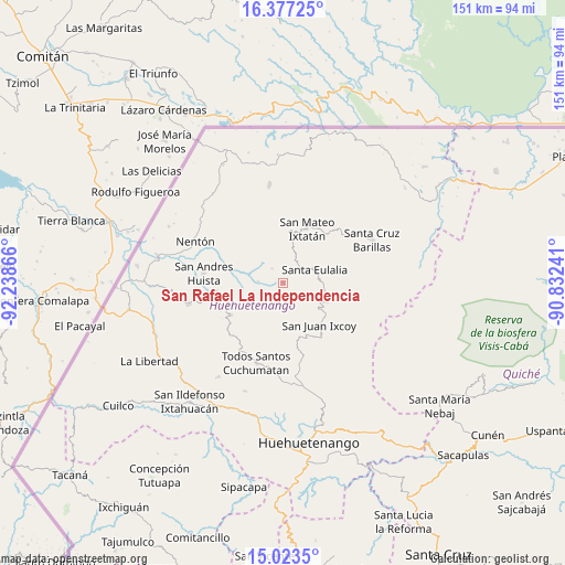
| Upper-left | 16.37725°, | -92.23866° |
| Center: | 15.7015°, | -91.53553° |
| Lower-right: | 15.0235°, | -90.83241° |
| Map W x H: | 150.5×150.5 km | = 93.5×93.5mi |
| max Lat: | 17.06606° ⇑8.3% North |
| San Rafael La Independencia: | 15.7015° |
| min Lat: | ⇓91.7% South 13.9274° |
| min Long | San Rafael La I | max Long |
| -92.19298° | -91.53553° | -88.59444° |
| W 24.8%⇐ | ⇒75.2% E |
Elevation
Elevation of San Rafael La Independencia is 2518 m = 8261 ft, and this is 1251 m = 4104 ft above average elevation for this country.
| Max E: |
3254 m = 10676 ft | 6.2% |
| San Rafael La Independencia | 2518 m 8261 ft | |
| Avg. | 1267 m = 4157 ft | |
Min E: |
1 m = 3 ft | 93.8% |
See also: Guatemala elevation on elevation.city.
Geographical zone
San Rafael La Independencia is located in North Torrid zone (between Equator and Tropic of Cancer). Distance of this Northern Tropic circle is 860.1 km =534.4 mi to North.| Distance of | km | miles | from San Rafael La Independencia |
|---|---|---|---|
| North Pole | 8261.2 | 5133.3 | to North |
| Arctic Circle | 5655.3 | 3514 | to North |
| Tropic Cancer | 860.1 | 534.4 | to North |
| Equator | 1745.8 | 1084.8 | to South |


Nearby cities:
15 places around San Rafael La Independencia: (largest is in red/bold)
• Barillas
26.1 km =16.2 mi,  64°
64°
• Concepción Huista
16.4 km =10.2 mi,  238°
238°
• Jacaltenango
19.3 km =12 mi,  258°
258°
• Nentón
25.9 km =16.1 mi,  295°
295°
• San Antonio Huista
25.9 km =16.1 mi, 257°
• San Juan Atitán
31.8 km =19.8 mi,  197°
197°
• San Juan Ixcoy
14.8 km =9.2 mi,  139°
139°
• San Mateo Ixtatán
15.8 km =9.8 mi,  22°
22°
• San Miguel Acatán
6.7 km =4.2 mi,  272°
272°
• San Sebastián Coatán
4.8 km =3 mi,  322°
322°
• Santa Ana Huista
30.5 km =19 mi, 265°
• Santa Eulalia
8.9 km =5.5 mi,  68°
68°
• Santiago Chimaltenango
30.4 km =18.9 mi,  214°
214°
• Soloma
12.3 km =7.6 mi,  112°
112°
• Todos Santos Cuchumatán
22.7 km =14.1 mi, 198°
Sources, notices
• [Note1] Compared only with cities in Guatemala existing in our database
• [Src1] Map data: © OpenStreetMap contributors (CC-BY-SA)
• [Src2] Other city data from geonames.org with taken over terms of usage.
• [Src3] Geographical zone / Annual Mean Temperature by Robert A. Rohde @ Wikipedia
