San Sebastián Coatán geodata
San Sebastián Coatán (Huehuetenango) is a seat of a second-order administrative division; located in Guatemala in America/Guatemala (GMT-6) time zone. With population of 801 people, there are 320 cities with bigger population in this country. Compared to other cities in Guatemala, 92.9% of cities are located further ↓South; 76.7% of cities are located further →East and 88.2% of cities have lower elevation than San Sebastián Coatán. Note1


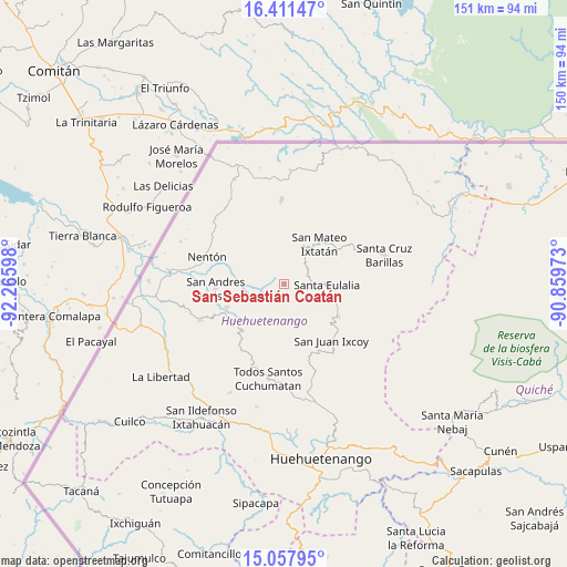
San Sebastián Coatán GPS coordinates[2]
15° 44' 9.024" North, 91° 33' 46.26" West
| Map corner | latitude | longitude |
|---|---|---|
| Upper-left | 16.41147°, | -92.26598° |
| Center: | 15.73584°, | -91.56285° |
| Lower-right: | 15.05795°, | -90.85973° |
| Map W x H: | 150.5×150.5 km | = 93.5×93.5mi |
| max Lat: | 17.06606° ⇑7.1% North |
| San Sebastián Coatán: | 15.73584° |
| min Lat: | ⇓92.9% South 13.9274° |
| min Long | San Sebastián | max Long |
| -92.19298° | -91.56285° | -88.59444° |
| W 23.3%⇐ | ⇒76.7% E |
Elevation
Elevation of San Sebastián Coatán is 2357 m = 7733 ft, and this is 1090 m = 3576 ft above average elevation for this country.
| Max E: |
3254 m = 10676 ft | 11.8% |
| San Sebastián Coatán | 2357 m 7733 ft | |
| Avg. | 1267 m = 4157 ft | |
Min E: |
1 m = 3 ft | 88.2% |
See also: Guatemala elevation on elevation.city.
Geographical zone
San Sebastián Coatán is located in North Torrid zone (between Equator and Tropic of Cancer). Distance of this Northern Tropic circle is 856.3 km =532.1 mi to North.| Distance of | km | miles | from San Sebastián Coatán |
|---|---|---|---|
| North Pole | 8257.4 | 5130.9 | to North |
| Arctic Circle | 5651.5 | 3511.7 | to North |
| Tropic Cancer | 856.3 | 532.1 | to North |
| Equator | 1749.7 | 1087.2 | to South |


Nearby cities:
15 places around San Sebastián Coatán: (largest is in red/bold)
• Barillas
27.5 km =17.1 mi,  74°
74°
• Concepción Huista
16.6 km =10.3 mi,  221°
221°
• Jacaltenango
17.7 km =11 mi,  244°
244°
• Nentón
21.8 km =13.5 mi,  289°
289°
• San Antonio Huista
24.3 km =15.1 mi,  246°
246°
• San Juan Ixcoy
19.6 km =12.2 mi,  140°
140°
• San Mateo Ixtatán
14 km =8.7 mi,  40°
40°
• San Miguel Acatán
5.1 km =3.2 mi,  226°
226°
• San Rafael La Independencia
4.8 km =3 mi, 142°
• Santa Ana Huista
28.2 km =17.5 mi,  257°
257°
• Santa Eulalia
11.2 km =7 mi,  92°
92°
• Santiago Chimaltenango
32.2 km =20 mi,  206°
206°
• Soloma
16.6 km =10.3 mi,  121°
121°
• Todos Santos Cuchumatán
25.7 km =16 mi,  189°
189°
• Unión
30.8 km =19.1 mi,  312°
312°
Sources, notices
• [Note1] Compared only with cities in Guatemala existing in our database
• [Src1] Map data: © OpenStreetMap contributors (CC-BY-SA)
• [Src2] Other city data from geonames.org with taken over terms of usage.
• [Src3] Geographical zone / Annual Mean Temperature by Robert A. Rohde @ Wikipedia
