San Mateo Ixtatán geodata
San Mateo Ixtatán (Huehuetenango) is a seat of a second-order administrative division; located in Guatemala in America/Guatemala (GMT-6) time zone. With population of 13,213 people, there are 94 cities with bigger population in this country. Compared to other cities in Guatemala, 95.3% of cities are located further ↓South; 71.4% of cities are located further →East and 96.2% of cities have lower elevation than San Mateo Ixtatán. Note1


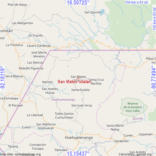
San Mateo Ixtatán GPS coordinates[2]
15° 49' 54.984" North, 91° 28' 41.016" West
| Map corner | latitude | longitude |
|---|---|---|
| Upper-left | 16.50725°, | -92.18119° |
| Center: | 15.83194°, | -91.47806° |
| Lower-right: | 15.15437°, | -90.77494° |
| Map W x H: | 150.4×150.4 km | = 93.5×93.5mi |
| max Lat: | 17.06606° ⇑4.7% North |
| San Mateo Ixtatán: | 15.83194° |
| min Lat: | ⇓95.3% South 13.9274° |
| min Long | San Mateo Ixtat | max Long |
| -92.19298° | -91.47806° | -88.59444° |
| W 28.6%⇐ | ⇒71.4% E |
Elevation
Elevation of San Mateo Ixtatán is 2599 m = 8527 ft, and this is 1332 m = 4370 ft above average elevation for this country.
| Max E: |
3254 m = 10676 ft | 3.8% |
| San Mateo Ixtatán | 2599 m 8527 ft | |
| Avg. | 1267 m = 4157 ft | |
Min E: |
1 m = 3 ft | 96.2% |
See also: Guatemala elevation on elevation.city.
Geographical zone
San Mateo Ixtatán is located in North Torrid zone (between Equator and Tropic of Cancer). Distance of this Northern Tropic circle is 845.6 km =525.4 mi to North.| Distance of | km | miles | from San Mateo Ixtatán |
|---|---|---|---|
| North Pole | 8246.7 | 5124.3 | to North |
| Arctic Circle | 5640.8 | 3505 | to North |
| Tropic Cancer | 845.6 | 525.4 | to North |
| Equator | 1760.3 | 1093.8 | to South |


Nearby cities:
15 places around San Mateo Ixtatán: (largest is in red/bold)
• Barillas
17.6 km =10.9 mi,  100°
100°
• Concepción Huista
30.6 km =19 mi,  220°
220°
• Jacaltenango
31 km =19.3 mi,  233°
233°
• Nentón
29.8 km =18.5 mi,  263°
263°
• San Antonio Huista
37.4 km =23.2 mi,  237°
237°
• San Juan Ixcoy
26 km =16.2 mi,  172°
172°
• San Luis Ixcán
41.3 km =25.7 mi, 96°
• San Miguel Acatán
19.1 km =11.9 mi, 221°
• San Rafael La Independencia
15.8 km =9.8 mi,  202°
202°
• San Sebastián Coatán
14 km =8.7 mi, 220°
• Santa Ana Huista
40.3 km =25 mi,  245°
245°
• Santa Eulalia
11.5 km =7.1 mi, 169°
• Soloma
20 km =12.4 mi, 165°
• Todos Santos Cuchumatán
38.4 km =23.9 mi, 200°
• Unión
33.4 km =20.8 mi,  287°
287°
Sources, notices
• [Note1] Compared only with cities in Guatemala existing in our database
• [Src1] Map data: © OpenStreetMap contributors (CC-BY-SA)
• [Src2] Other city data from geonames.org with taken over terms of usage.
• [Src3] Geographical zone / Annual Mean Temperature by Robert A. Rohde @ Wikipedia
