Pusztavám geodata
Pusztavám (Fejér) is a populated place; located in Hungary in Europe/Budapest (GMT+2) time zone. With population of 2,521 people, there are 611 cities with bigger population in this country. Compared to other cities in Hungary, 51% of cities are located further ↓South; 82.8% of cities are located further →East and 93.1% of cities have lower elevation than Pusztavám. Note1


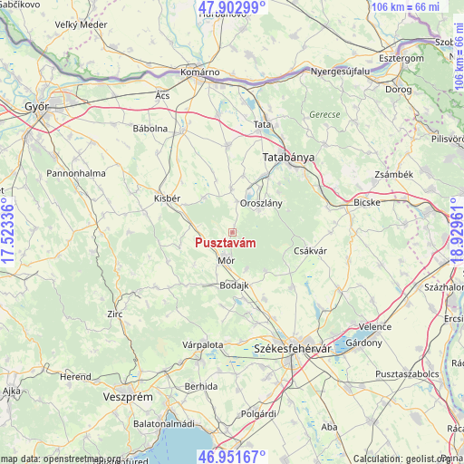
Pusztavám GPS coordinates[2]
47° 25' 46.128" North, 18° 13' 35.328" East
| Map corner | latitude | longitude |
|---|---|---|
| Upper-left | 47.90299°, | 17.52336° |
| Center: | 47.42948°, | 18.22648° |
| Lower-right: | 46.95167°, | 18.92961° |
| Map W x H: | 105.8×105.8 km | = 65.7×65.7mi |
| max Lat: | 48.46667° ⇑49% North |
| Pusztavám: | 47.42948° |
| min Lat: | ⇓51% South 45.79108° |
| min Long | Pusztavám | max Long |
| 16.27358° | 18.22648° | 22.68096° |
| W 17.2%⇐ | ⇒82.8% E |
Elevation
Elevation of Pusztavám is 207 m = 679 ft, and this is 77.3 m = 254 ft above average elevation for this country.
| Max E: |
444 m = 1457 ft | 6.9% |
| Pusztavám | 207 m 679 ft | |
| Avg. | 129.7 m = 426 ft | |
Min E: |
71 m = 233 ft | 93.1% |
See also: Hungary elevation on elevation.city.
Geographical zone
Pusztavám is located in North temperate zone (between Tropic of Cancer and the Arctic Circle). Distance of this North polar circle is 2127.5 km =1322 mi to North.| Distance of | km | miles | from Pusztavám |
|---|---|---|---|
| North Pole | 4733.4 | 2941.2 | to North |
| Arctic Circle | 2127.5 | 1322 | to North |
| Tropic Cancer | 2667.7 | 1657.6 | to South |
| Equator | 5273.7 | 3276.9 | to South |


Nearby cities:
15 places around Pusztavám: (largest is in red/bold)
• Bakonycsernye
16.4 km =10.2 mi,  224°
224°
• Bodajk
11.8 km =7.3 mi,  177°
177°
• Bokod
7.1 km =4.4 mi,  12°
12°
• Csákvár
18.4 km =11.4 mi,  103°
103°
• Császár
9.9 km =6.2 mi,  320°
320°
• Ete
16 km =9.9 mi,  314°
314°
• Fehérvárcsurgó
15.4 km =9.6 mi,  169°
169°
• Kecskéd
12.1 km =7.5 mi,  30°
30°
• Kincsesbánya
18.8 km =11.7 mi, 168°
• Kisbér
16.4 km =10.2 mi,  299°
299°
• Kocs
19.8 km =12.3 mi,  357°
357°
• Környe
14.8 km =9.2 mi, 28°
• Mór
6 km =3.7 mi,  196°
196°
• Oroszlány
9.1 km =5.7 mi,  45°
45°
• Zámoly
18.6 km =11.6 mi,  132°
132°
Sources, notices
• [Note1] Compared only with cities in Hungary existing in our database
• [Src1] Map data: © OpenStreetMap contributors (CC-BY-SA)
• [Src2] Other city data from geonames.org with taken over terms of usage.
• [Src3] Geographical zone / Annual Mean Temperature by Robert A. Rohde @ Wikipedia
