Ajka geodata
Ajka (Veszprém) is a seat of a second-order administrative division; located in Hungary in Europe/Budapest (GMT+2) time zone. With population of 31,407 people, there are 57 cities with bigger population in this country. Compared to other cities in Hungary, 65.3% of cities are located further ↑North; 90.7% of cities are located further →East and 95.3% of cities have lower elevation than Ajka. Note1


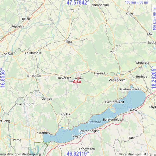
Ajka GPS coordinates[2]
47° 6' 7.056" North, 17° 33' 32.112" East
| Map corner | latitude | longitude |
|---|---|---|
| Upper-left | 47.57842°, | 16.8558° |
| Center: | 47.10196°, | 17.55892° |
| Lower-right: | 46.62119°, | 18.26205° |
| Map W x H: | 106.4×106.4 km | = 66.1×66.1mi |
| max Lat: | 48.46667° ⇑65.3% North |
| Ajka: | 47.10196° |
| min Lat: | ⇓34.7% South 45.79108° |
| min Long | Ajka | max Long |
| 16.27358° | 17.55892° | 22.68096° |
| W 9.3%⇐ | ⇒90.7% E |
Elevation
Elevation of Ajka is 225 m = 738 ft, and this is 95.3 m = 313 ft above average elevation for this country.
| Max E: |
444 m = 1457 ft | 4.7% |
| Ajka | 225 m 738 ft | |
| Avg. | 129.7 m = 426 ft | |
Min E: |
71 m = 233 ft | 95.3% |
See also: Hungary elevation on elevation.city.
Geographical zone
Ajka is located in North temperate zone (between Tropic of Cancer and the Arctic Circle). Distance of this North polar circle is 2163.9 km =1344.6 mi to North.| Distance of | km | miles | from Ajka |
|---|---|---|---|
| North Pole | 4769.8 | 2963.8 | to North |
| Arctic Circle | 2163.9 | 1344.6 | to North |
| Tropic Cancer | 2631.3 | 1635 | to South |
| Equator | 5237.2 | 3254.2 | to South |


Nearby cities:
15 places around Ajka: (largest is in red/bold)
• Balatonfüred
28.4 km =17.6 mi,  123°
123°
• Bánd
17 km =10.6 mi,  82°
82°
• Csabrendek
22.5 km =14 mi,  244°
244°
• Csopak
30.6 km =19 mi, 117°
• Devecser
9.2 km =5.7 mi,  270°
270°
• Herend
14.9 km =9.3 mi, 76°
• Jánosháza
29.9 km =18.6 mi, 273°
• Nemesvámos
24.5 km =15.2 mi,  102°
102°
• Pápa
26.3 km =16.3 mi,  344°
344°
• Sümeg
25.2 km =15.7 mi, 236°
• Tapolca
26.1 km =16.2 mi,  200°
200°
• Veszprém
26.7 km =16.6 mi,  92°
92°
• Zirc
29.8 km =18.5 mi,  52°
52°
• Zánka
27.3 km =17 mi,  159°
159°
• Úrkút
6.7 km =4.2 mi,  106°
106°
Sources, notices
• [Note1] Compared only with cities in Hungary existing in our database
• [Src1] Map data: © OpenStreetMap contributors (CC-BY-SA)
• [Src2] Other city data from geonames.org with taken over terms of usage.
• [Src3] Geographical zone / Annual Mean Temperature by Robert A. Rohde @ Wikipedia
