Genyem geodata
Genyem (Papua) is a seat of a third-order administrative division; located in Indonesia in Asia/Jayapura (GMT+9) time zone. In our database, there are 407 cities with bigger population. Compared to other cities in Indonesia, 92.1% of cities are located further ↓South; 99.8% of cities are located further ←West and 64.2% of cities have higher elevation than Genyem. Note1


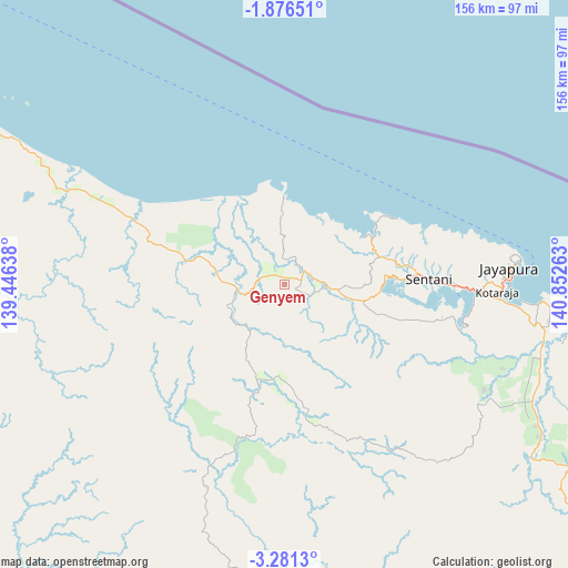
Genyem GPS coordinates[2]
2° 34' 44.76" South, 140° 8' 58.2" East
| Map corner | latitude | longitude |
|---|---|---|
| Upper-left | -1.87651°, | 139.44638° |
| Center: | -2.5791°, | 140.1495° |
| Lower-right: | -3.2813°, | 140.85263° |
| Map W x H: | 156.2×156.2 km | = 97.1×97.1mi |
| max Lat: | 5.88969° ⇑7.9% North |
| Genyem: | -2.5791° |
| min Lat: | ⇓92.1% South -10.934° |
| min Long | Genyem | max Long |
| 95.1345° | 140.1495° | 140.9419° |
| W 99.8%⇐ | ⇒0.2% E |
Elevation
Elevation of Genyem is 45 m = 148 ft, and this is 184.7 m = 606 ft below average elevation for this country.
| Max E: |
3185 m = 10449 ft | 64.2% |
| Avg. | 229.7 m = 754 ft | |
| Genyem | 45 m = 148 ft | |
Min E: |
-1 m = -3 ft | 35.8% |
See also: Indonesia elevation on elevation.city.
Geographical zone
Genyem is located in South Torrid zone (between Equator and Tropic of Capricorn). Distance of Equator is 286.8 km =178.2 mi to North.| Distance of | km | miles | from Genyem |
|---|---|---|---|
| Equator | 286.8 | 178.2 | to North |
| Tropic Capricorn | 2319.1 | 1441 | to South |
| Antarctic Circle | 7114.4 | 4420.7 | to South |
| South Pole | 9720.3 | 6039.9 | to South |


Nearby cities:
15 places around Genyem: (largest is in red/bold)
• Abepura
53.7 km =33.4 mi,  92°
92°
• Armopa
63.1 km =39.2 mi,  294°
294°
• Arso
77.3 km =48 mi,  117°
117°
• Banda
110.5 km =68.7 mi,  127°
127°
• Betaf
112.2 km =69.7 mi,  297°
297°
• Demta
24.5 km =15.2 mi,  359°
359°
• Depapre
26.7 km =16.6 mi,  67°
67°
• Elelim
140.1 km =87.1 mi,  200°
200°
• Guay
38.7 km =24 mi,  282°
282°
• Jayapura
63.4 km =39.4 mi, 85°
• Samanente
147.2 km =91.5 mi, 286°
• Sawoi
21.3 km =13.2 mi,  103°
103°
• Sengge
118.9 km =73.9 mi,  144°
144°
• Sentani
40.4 km =25.1 mi, 88°
• Waris
101.1 km =62.8 mi, 126°
Sources, notices
• [Note1] Compared only with cities in Indonesia existing in our database
• [Src1] Map data: © OpenStreetMap contributors (CC-BY-SA)
• [Src2] Other city data from geonames.org with taken over terms of usage.
• [Src3] Geographical zone / Annual Mean Temperature by Robert A. Rohde @ Wikipedia
