Arso geodata
Arso (Papua) is a seat of a third-order administrative division; located in Indonesia in Asia/Jayapura (GMT+9) time zone. In our database, there are 407 cities with bigger population. Compared to other cities in Indonesia, 91.5% of cities are located further ↓South; 100% of cities are located further ←West and 64.2% of cities have higher elevation than Arso. Note1


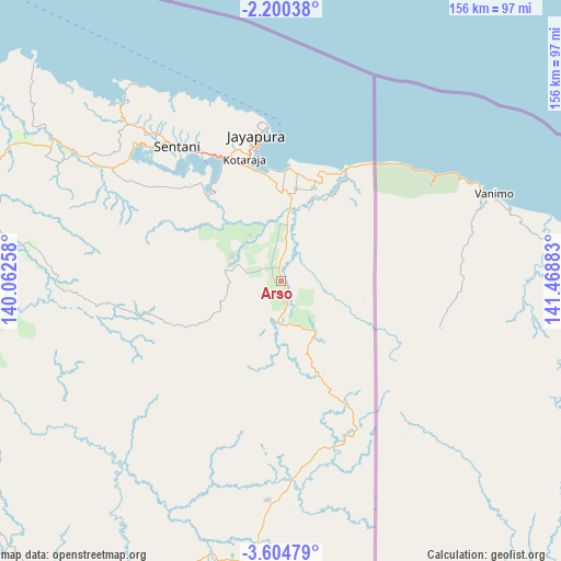
Arso GPS coordinates[2]
2° 54' 10.08" South, 140° 45' 56.52" East
| Map corner | latitude | longitude |
|---|---|---|
| Upper-left | -2.20038°, | 140.06258° |
| Center: | -2.9028°, | 140.7657° |
| Lower-right: | -3.60479°, | 141.46883° |
| Map W x H: | 156.2×156.2 km | = 97.1×97.1mi |
| max Lat: | 5.88969° ⇑8.5% North |
| Arso: | -2.9028° |
| min Lat: | ⇓91.5% South -10.934° |
| min Long | Arso | max Long |
| 95.1345° | 140.7657° | 140.9419° |
| W 100%⇐ | ⇒0% E |
Elevation
Elevation of Arso is 45 m = 148 ft, and this is 184.7 m = 606 ft below average elevation for this country.
| Max E: |
3185 m = 10449 ft | 64.2% |
| Avg. | 229.7 m = 754 ft | |
| Arso | 45 m = 148 ft | |
Min E: |
-1 m = -3 ft | 35.8% |
See also: Indonesia elevation on elevation.city.
Geographical zone
Arso is located in South Torrid zone (between Equator and Tropic of Capricorn). Distance of Equator is 322.8 km =200.6 mi to North.| Distance of | km | miles | from Arso |
|---|---|---|---|
| Equator | 322.8 | 200.6 | to North |
| Tropic Capricorn | 2283.2 | 1418.7 | to South |
| Antarctic Circle | 7078.4 | 4398.3 | to South |
| South Pole | 9684.3 | 6017.5 | to South |


Nearby cities:
15 places around Arso: (largest is in red/bold)
• Abepura
37.1 km =23.1 mi,  336°
336°
• Armopa
140.4 km =87.2 mi,  296°
296°
• Banda
36.5 km =22.7 mi,  147°
147°
• Betaf
189.6 km =117.8 mi, 297°
• Demta
91.5 km =56.9 mi,  311°
311°
• Depapre
63.7 km =39.6 mi,  316°
316°
• Elelim
151.2 km =94 mi,  230°
230°
• Genyem
77.3 km =48 mi, 297°
• Guay
115.1 km =71.5 mi,  292°
292°
• Jayapura
41.4 km =25.7 mi,  352°
352°
• Sawoi
56.9 km =35.4 mi, 302°
• Sengge
60.6 km =37.7 mi,  179°
179°
• Sentani
46.5 km =28.9 mi, 322°
• Ubrub
91 km =56.5 mi,  172°
172°
• Waris
27.1 km =16.8 mi, 151°
Sources, notices
• [Note1] Compared only with cities in Indonesia existing in our database
• [Src1] Map data: © OpenStreetMap contributors (CC-BY-SA)
• [Src2] Other city data from geonames.org with taken over terms of usage.
• [Src3] Geographical zone / Annual Mean Temperature by Robert A. Rohde @ Wikipedia
