Abepura geodata
Abepura (Papua) is a seat of a third-order administrative division; located in Indonesia in Asia/Jayapura (GMT+9) time zone. With population of 62,248 people, there are 193 cities with bigger population in this country. Compared to other cities in Indonesia, 92% of cities are located further ↓South; 99.9% of cities are located further ←West and 55% of cities have higher elevation than Abepura. Note1


Abepura GPS coordinates[2]
2° 35' 47.04" South, 140° 37' 56.64" East
| Map corner | latitude | longitude |
|---|---|---|
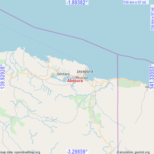
| Upper-left | -1.89382°, | 139.92928° |
| Center: | -2.5964°, | 140.6324° |
| Lower-right: | -3.29859°, | 141.33553° |
| Map W x H: | 156.2×156.2 km | = 97.1×97.1mi |
| max Lat: | 5.88969° ⇑8% North |
| Abepura: | -2.5964° |
| min Lat: | ⇓92% South -10.934° |
| min Long | Abepura | max Long |
| 95.1345° | 140.6324° | 140.9419° |
| W 99.9%⇐ | ⇒0.099999999999994% E |
Elevation
Elevation of Abepura is 85 m = 279 ft, and this is 144.7 m = 475 ft below average elevation for this country.
| Max E: |
3185 m = 10449 ft | 55% |
| Avg. | 229.7 m = 754 ft | |
| Abepura | 85 m = 279 ft | |
Min E: |
-1 m = -3 ft | 45% |
See also: Abepura elevation on elevation.city.
Geographical zone
Abepura is located in South Torrid zone (between Equator and Tropic of Capricorn). Distance of Equator is 288.7 km =179.4 mi to North.| Distance of | km | miles | from Abepura |
|---|---|---|---|
| Equator | 288.7 | 179.4 | to North |
| Tropic Capricorn | 2317.2 | 1439.8 | to South |
| Antarctic Circle | 7112.5 | 4419.5 | to South |
| South Pole | 9718.4 | 6038.7 | to South |


Nearby cities:
15 places around Abepura: (largest is in red/bold)
• Armopa
114.5 km =71.1 mi,  284°
284°
• Arso
37.1 km =23.1 mi,  156°
156°
• Banda
73.4 km =45.6 mi,  152°
152°
• Betaf
162.4 km =100.9 mi,  289°
289°
• Demta
60 km =37.3 mi,  296°
296°
• Depapre
31.5 km =19.6 mi, 292°
• Elelim
165.1 km =102.6 mi,  218°
218°
• Genyem
53.7 km =33.4 mi,  272°
272°
• Guay
91.9 km =57.1 mi, 276°
• Jayapura
11.8 km =7.3 mi,  53°
53°
• Sawoi
33.1 km =20.6 mi,  264°
264°
• Sengge
96 km =59.7 mi,  170°
170°
• Sentani
13.6 km =8.5 mi, 282°
• Ubrub
127.2 km =79 mi, 167°
• Waris
64.2 km =39.9 mi, 154°
Sources, notices
• [Note1] Compared only with cities in Indonesia existing in our database
• [Src1] Map data: © OpenStreetMap contributors (CC-BY-SA)
• [Src2] Other city data from geonames.org with taken over terms of usage.
• [Src3] Geographical zone / Annual Mean Temperature by Robert A. Rohde @ Wikipedia
