Banda geodata
Banda (Papua) is a seat of a third-order administrative division; located in Indonesia in Asia/Jayapura (GMT+9) time zone. In our database, there are 407 cities with bigger population. Compared to other cities in Indonesia, 91% of cities are located further ↓South; 100% of cities are located further ←West and 84.5% of cities have lower elevation than Banda. Note1


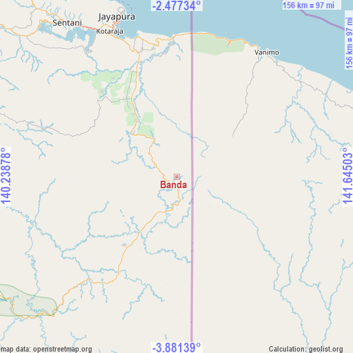
Banda GPS coordinates[2]
3° 10' 46.56" South, 140° 56' 30.84" East
| Map corner | latitude | longitude |
|---|---|---|
| Upper-left | -2.47734°, | 140.23878° |
| Center: | -3.1796°, | 140.9419° |
| Lower-right: | -3.88139°, | 141.64503° |
| Map W x H: | 156.1×156.1 km | = 97×97mi |
| max Lat: | 5.88969° ⇑9% North |
| Banda: | -3.1796° |
| min Lat: | ⇓91% South -10.934° |
| min Long | Banda | max Long |
| 95.1345° | 140.9419° | 140.9419° |
| W 100%⇐ | ⇒0% E |
Elevation
Elevation of Banda is 509 m = 1670 ft, and this is 279.3 m = 916 ft above average elevation for this country.
| Max E: |
3185 m = 10449 ft | 15.5% |
| Banda | 509 m 1670 ft | |
| Avg. | 229.7 m = 754 ft | |
Min E: |
-1 m = -3 ft | 84.5% |
See also: Indonesia elevation on elevation.city.
Geographical zone
Banda is located in South Torrid zone (between Equator and Tropic of Capricorn). Distance of Equator is 353.5 km =219.7 mi to North.| Distance of | km | miles | from Banda |
|---|---|---|---|
| Equator | 353.5 | 219.7 | to North |
| Tropic Capricorn | 2252.4 | 1399.6 | to South |
| Antarctic Circle | 7047.6 | 4379.2 | to South |
| South Pole | 9653.5 | 5998.4 | to South |


Nearby cities:
15 places around Banda: (largest is in red/bold)
• Abepura
73.4 km =45.6 mi,  332°
332°
• Armopa
172.7 km =107.3 mi,  302°
302°
• Arso
36.5 km =22.7 mi, 327°
• Demta
126.9 km =78.9 mi,  315°
315°
• Depapre
99.8 km =62 mi, 320°
• Elelim
151.4 km =94.1 mi,  244°
244°
• Genyem
110.5 km =68.7 mi,  307°
307°
• Guay
146.5 km =91 mi, 300°
• Jayapura
76 km =47.2 mi,  340°
340°
• Oksibil
194.9 km =121.1 mi,  190°
190°
• Sawoi
91.3 km =56.7 mi, 312°
• Sengge
35.1 km =21.8 mi,  211°
211°
• Sentani
82.9 km =51.5 mi, 324°
• Ubrub
59.7 km =37.1 mi, 186°
• Waris
9.6 km =6 mi, 317°
Sources, notices
• [Note1] Compared only with cities in Indonesia existing in our database
• [Src1] Map data: © OpenStreetMap contributors (CC-BY-SA)
• [Src2] Other city data from geonames.org with taken over terms of usage.
• [Src3] Geographical zone / Annual Mean Temperature by Robert A. Rohde @ Wikipedia
