Semuda geodata
Semuda (Central Kalimantan) is a seat of a third-order administrative division; located in Indonesia in Asia/Pontianak (GMT+7) time zone. In our database, there are 407 cities with bigger population. Compared to other cities in Indonesia, 91.6% of cities are located further ↓South; 58.8% of cities are located further ←West and 92.1% of cities have higher elevation than Semuda. Note1


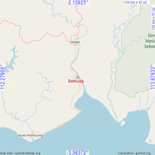
Semuda GPS coordinates[2]
2° 51' 42.12" South, 112° 58' 23.52" East
| Map corner | latitude | longitude |
|---|---|---|
| Upper-left | -2.15925°, | 112.27008° |
| Center: | -2.8617°, | 112.9732° |
| Lower-right: | -3.56372°, | 113.67633° |
| Map W x H: | 156.2×156.2 km | = 97.1×97.1mi |
| max Lat: | 5.88969° ⇑8.4% North |
| Semuda: | -2.8617° |
| min Lat: | ⇓91.6% South -10.934° |
| min Long | Semuda | max Long |
| 95.1345° | 112.9732° | 140.9419° |
| W 58.8%⇐ | ⇒41.2% E |
Elevation
Elevation of Semuda is 9 m = 30 ft, and this is 220.7 m = 724 ft below average elevation for this country.
| Max E: |
3185 m = 10449 ft | 92.1% |
| Avg. | 229.7 m = 754 ft | |
| Semuda | 9 m = 30 ft | |
Min E: |
-1 m = -3 ft | 7.9% |
See also: Indonesia elevation on elevation.city.
Geographical zone
Semuda is located in South Torrid zone (between Equator and Tropic of Capricorn). Distance of Equator is 318.2 km =197.7 mi to North.| Distance of | km | miles | from Semuda |
|---|---|---|---|
| Equator | 318.2 | 197.7 | to North |
| Tropic Capricorn | 2287.7 | 1421.5 | to South |
| Antarctic Circle | 7083 | 4401.2 | to South |
| South Pole | 9688.9 | 6020.4 | to South |


Nearby cities:
15 places around Semuda: (largest is in red/bold)
• Basarang
147.7 km =91.8 mi,  94°
94°
• Halimaung Jaya (F-3)
64.3 km =40 mi,  227°
227°
• Kotabesi
54.6 km =33.9 mi,  3°
3°
• Kuala Pembuang
75.4 km =46.9 mi,  218°
218°
• Kumai
139.2 km =86.5 mi,  275°
275°
• Pagatan
49 km =30.4 mi,  134°
134°
• Palangkaraya
127.5 km =79.2 mi,  55°
55°
• Pangkalanbuun
150.9 km =93.8 mi, 277°
• Pembuanghulu
99.3 km =61.7 mi,  293°
293°
• Petakbehandang
101.2 km =62.9 mi,  30°
30°
• Pulang Pisau
141.1 km =87.7 mi, 85°
• Rantaupulut
128.2 km =79.7 mi,  317°
317°
• Sampit
36.8 km =22.9 mi,  355°
355°
• Semilat
104.6 km =65 mi,  306°
306°
• Tongkiling
128.7 km =80 mi,  51°
51°
Sources, notices
• [Note1] Compared only with cities in Indonesia existing in our database
• [Src1] Map data: © OpenStreetMap contributors (CC-BY-SA)
• [Src2] Other city data from geonames.org with taken over terms of usage.
• [Src3] Geographical zone / Annual Mean Temperature by Robert A. Rohde @ Wikipedia
