Semilat geodata
Semilat (Central Kalimantan) is a seat of a third-order administrative division; located in Indonesia in Asia/Pontianak (GMT+7) time zone. In our database, there are 407 cities with bigger population. Compared to other cities in Indonesia, 92.5% of cities are located further ↓South; 51.5% of cities are located further ←West and 72.7% of cities have higher elevation than Semilat. Note1


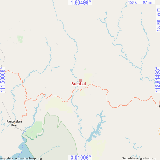
Semilat GPS coordinates[2]
2° 18' 27.72" South, 112° 12' 42.48" East
| Map corner | latitude | longitude |
|---|---|---|
| Upper-left | -1.60499°, | 111.50868° |
| Center: | -2.3077°, | 112.2118° |
| Lower-right: | -3.01006°, | 112.91493° |
| Map W x H: | 156.2×156.2 km | = 97.1×97.1mi |
| max Lat: | 5.88969° ⇑7.5% North |
| Semilat: | -2.3077° |
| min Lat: | ⇓92.5% South -10.934° |
| min Long | Semilat | max Long |
| 95.1345° | 112.2118° | 140.9419° |
| W 51.5%⇐ | ⇒48.5% E |
Elevation
Elevation of Semilat is 28 m = 92 ft, and this is 201.7 m = 662 ft below average elevation for this country.
| Max E: |
3185 m = 10449 ft | 72.7% |
| Avg. | 229.7 m = 754 ft | |
| Semilat | 28 m = 92 ft | |
Min E: |
-1 m = -3 ft | 27.3% |
See also: Indonesia elevation on elevation.city.
Geographical zone
Semilat is located in South Torrid zone (between Equator and Tropic of Capricorn). Distance of Equator is 256.6 km =159.4 mi to North.| Distance of | km | miles | from Semilat |
|---|---|---|---|
| Equator | 256.6 | 159.4 | to North |
| Tropic Capricorn | 2349.3 | 1459.8 | to South |
| Antarctic Circle | 7144.6 | 4439.4 | to South |
| South Pole | 9750.5 | 6058.7 | to South |


Nearby cities:
15 places around Semilat: (largest is in red/bold)
• Halimaung Jaya (F-3)
111.1 km =69 mi,  160°
160°
• Kotabesi
88.1 km =54.7 mi,  94°
94°
• Kotawaringin
84.1 km =52.3 mi,  257°
257°
• Kuala Pembuang
126.3 km =78.5 mi, 162°
• Kumai
72.3 km =44.9 mi,  228°
228°
• Manismata
132.1 km =82.1 mi, 262°
• Nanga Bulik
82 km =51 mi,  281°
281°
• Pagatan
153.2 km =95.2 mi,  128°
128°
• Pangkalanbuun
77.3 km =48 mi,  237°
237°
• Pembuanghulu
23.4 km =14.5 mi,  196°
196°
• Petakbehandang
138.4 km =86 mi,  79°
79°
• Rantaupulut
33.2 km =20.6 mi,  356°
356°
• Sampit
85.7 km =53.3 mi,  106°
106°
• Semuda
104.6 km =65 mi, 126°
• Tongkiling
185.8 km =115.5 mi, 84°
Sources, notices
• [Note1] Compared only with cities in Indonesia existing in our database
• [Src1] Map data: © OpenStreetMap contributors (CC-BY-SA)
• [Src2] Other city data from geonames.org with taken over terms of usage.
• [Src3] Geographical zone / Annual Mean Temperature by Robert A. Rohde @ Wikipedia
