Halimaung Jaya (F-3) geodata
Halimaung Jaya (F-3) (Central Kalimantan) is a seat of a fourth-order administrative division; located in Indonesia in Asia/Pontianak (GMT+7) time zone. In our database, there are 407 cities with bigger population. Compared to other cities in Indonesia, 90.8% of cities are located further ↓South; 55.4% of cities are located further ←West and 99.4% of cities have higher elevation than Halimaung Jaya (F-3). Note1


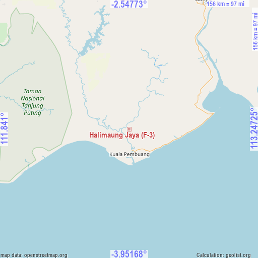
Halimaung Jaya (F-3) GPS coordinates[2]
3° 14' 59.82" South, 112° 32' 38.832" East
| Map corner | latitude | longitude |
|---|---|---|
| Upper-left | -2.54773°, | 111.841° |
| Center: | -3.24995°, | 112.54412° |
| Lower-right: | -3.95168°, | 113.24725° |
| Map W x H: | 156.1×156.1 km | = 97×97mi |
| max Lat: | 5.88969° ⇑9.2% North |
| Halimaung Jaya (F-3): | -3.24995° |
| min Lat: | ⇓90.8% South -10.934° |
| min Long | Halimaung Jaya | max Long |
| 95.1345° | 112.54412° | 140.9419° |
| W 55.4%⇐ | ⇒44.6% E |
Elevation
Elevation of Halimaung Jaya (F-3) is 3 m = 10 ft, and this is 226.7 m = 744 ft below average elevation for this country.
| Max E: |
3185 m = 10449 ft | 99.4% |
| Avg. | 229.7 m = 754 ft | |
| Halimaung Jaya (F-3) | 3 m = 10 ft | |
Min E: |
-1 m = -3 ft | 0.6% |
See also: Indonesia elevation on elevation.city.
Geographical zone
Halimaung Jaya (F-3) is located in South Torrid zone (between Equator and Tropic of Capricorn). Distance of Equator is 361.4 km =224.6 mi to North.| Distance of | km | miles | from Halimaung Jaya (F-3) |
|---|---|---|---|
| Equator | 361.4 | 224.6 | to North |
| Tropic Capricorn | 2244.6 | 1394.7 | to South |
| Antarctic Circle | 7039.8 | 4374.3 | to South |
| South Pole | 9645.7 | 5993.6 | to South |


Nearby cities:
15 places around Halimaung Jaya (F-3): (largest is in red/bold)
• Kotabesi
110.1 km =68.4 mi,  27°
27°
• Kotawaringin
147 km =91.3 mi,  305°
305°
• Kuala Pembuang
15.8 km =9.8 mi,  177°
177°
• Kumai
107.1 km =66.5 mi,  301°
301°
• Manismata
189 km =117.4 mi, 297°
• Nanga Bulik
168.4 km =104.6 mi,  315°
315°
• Pagatan
83.1 km =51.6 mi,  83°
83°
• Palangkaraya
191.4 km =118.9 mi,  52°
52°
• Pangkalanbuun
119.9 km =74.5 mi, 301°
• Pembuanghulu
93.2 km =57.9 mi,  332°
332°
• Petakbehandang
163.8 km =101.8 mi,  37°
37°
• Rantaupulut
143.3 km =89 mi,  344°
344°
• Sampit
91.7 km =57 mi, 29°
• Semilat
111.1 km =69 mi, 340°
• Semuda
64.3 km =40 mi, 47°
Sources, notices
• [Note1] Compared only with cities in Indonesia existing in our database
• [Src1] Map data: © OpenStreetMap contributors (CC-BY-SA)
• [Src2] Other city data from geonames.org with taken over terms of usage.
• [Src3] Geographical zone / Annual Mean Temperature by Robert A. Rohde @ Wikipedia
