Sawangan geodata
Sawangan (West Java) is a populated place; located in Indonesia in Asia/Jakarta (GMT+7) time zone. With population of 114,069 people, there are 115 cities with bigger population in this country. Compared to other cities in Indonesia, 85.2% of cities are located further ↓South; 86.5% of cities are located further →East and 54.3% of cities have higher elevation than Sawangan. Note1


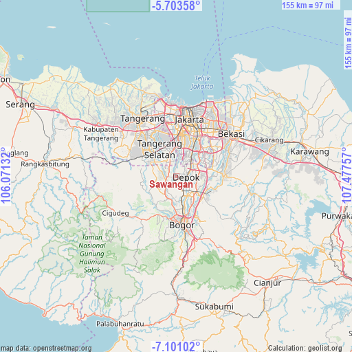
Sawangan GPS coordinates[2]
6° 24' 10.008" South, 106° 46' 27.984" East
| Map corner | latitude | longitude |
|---|---|---|
| Upper-left | -5.70358°, | 106.07132° |
| Center: | -6.40278°, | 106.77444° |
| Lower-right: | -7.10102°, | 107.47757° |
| Map W x H: | 155.4×155.4 km | = 96.6×96.6mi |
| max Lat: | 5.88969° ⇑14.8% North |
| Sawangan: | -6.40278° |
| min Lat: | ⇓85.2% South -10.934° |
| min Long | Sawangan | max Long |
| 95.1345° | 106.77444° | 140.9419° |
| W 13.5%⇐ | ⇒86.5% E |
Elevation
Elevation of Sawangan is 88 m = 289 ft, and this is 141.7 m = 465 ft below average elevation for this country.
| Max E: |
3185 m = 10449 ft | 54.3% |
| Avg. | 229.7 m = 754 ft | |
| Sawangan | 88 m = 289 ft | |
Min E: |
-1 m = -3 ft | 45.7% |
See also: Sawangan elevation on elevation.city.
Geographical zone
Sawangan is located in South Torrid zone (between Equator and Tropic of Capricorn). Distance of Equator is 711.9 km =442.4 mi to North.| Distance of | km | miles | from Sawangan |
|---|---|---|---|
| Equator | 711.9 | 442.4 | to North |
| Tropic Capricorn | 1894 | 1176.9 | to South |
| Antarctic Circle | 6689.3 | 4156.5 | to South |
| South Pole | 9295.1 | 5775.7 | to South |


Nearby cities:
15 places around Sawangan: (largest is in red/bold)
• Bekasi
30.2 km =18.8 mi,  51°
51°
• Bogor
21.4 km =13.3 mi,  175°
175°
• Ciampea
18.7 km =11.6 mi,  205°
205°
• Cibinong
12.4 km =7.7 mi,  134°
134°
• Cileungsir
20.4 km =12.7 mi,  87°
87°
• Ciputat
20.3 km =12.6 mi,  334°
334°
• Citeureup
15 km =9.3 mi, 127°
• Curug
28.5 km =17.7 mi,  302°
302°
• Depok
4.9 km =3 mi, 86°
• Jakarta
22.3 km =13.9 mi,  20°
20°
• Pamulang
7.8 km =4.8 mi, 329°
• Parung
5 km =3.1 mi,  245°
245°
• Serpong
15.5 km =9.6 mi,  308°
308°
• South Tangerang
14.1 km =8.8 mi, 333°
• Tangerang
29.7 km =18.5 mi, 327°
Sources, notices
• [Note1] Compared only with cities in Indonesia existing in our database
• [Src1] Map data: © OpenStreetMap contributors (CC-BY-SA)
• [Src2] Other city data from geonames.org with taken over terms of usage.
• [Src3] Geographical zone / Annual Mean Temperature by Robert A. Rohde @ Wikipedia
