Monaghan geodata
Monaghan (Ulster) is a seat of a first-order administrative division; located in Ireland in Europe/Dublin (GMT+0) time zone. With population of 5,937 people, there are 115 cities with bigger population in this country. Compared to other cities in Ireland, 92.4% of cities are located further ↓South; 59.8% of cities are located further ←West and 72.1% of cities have lower elevation than Monaghan. Note1


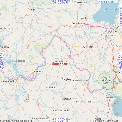
Monaghan GPS coordinates[2]
54° 15' 0" North, 6° 58' 0.012" West
| Map corner | latitude | longitude |
|---|---|---|
| Upper-left | 54.65876°, | -7.66979° |
| Center: | 54.25°, | -6.96667° |
| Lower-right: | 53.83715°, | -6.26354° |
| Map W x H: | 91.4×91.4 km | = 56.8×56.8mi |
| max Lat: | 55.25° ⇑7.6% North |
| Monaghan: | 54.25° |
| min Lat: | ⇓92.4% South 51.52487° |
| min Long | Monaghan | max Long |
| -10.26889° | -6.96667° | -6.04944° |
| W 59.8%⇐ | ⇒40.2% E |
Elevation
Elevation of Monaghan is 75 m = 246 ft, and this is 20.5 m = 67 ft above average elevation for this country.
| Max E: |
262 m = 860 ft | 27.9% |
| Monaghan | 75 m 246 ft | |
| Avg. | 54.5 m = 179 ft | |
Min E: |
0 m = 0 ft | 72.1% |
See also: Ireland elevation on elevation.city.
Geographical zone
Monaghan is located in North temperate zone (between Tropic of Cancer and the Arctic Circle). Distance of this North polar circle is 1369.1 km =850.7 mi to North.| Distance of | km | miles | from Monaghan |
|---|---|---|---|
| North Pole | 3975 | 2469.9 | to North |
| Arctic Circle | 1369.1 | 850.7 | to North |
| Tropic Cancer | 3426.1 | 2128.9 | to South |
| Equator | 6032 | 3748.1 | to South |


Nearby cities:
15 places around Monaghan: (largest is in red/bold)
• Bailieborough
37.1 km =23.1 mi,  180°
180°
• Ballyconnell
42.8 km =26.6 mi,  249°
249°
• Ballyhaise
31.8 km =19.8 mi,  225°
225°
• Belturbet
35.6 km =22.1 mi,  242°
242°
• Carrickmacross
34.8 km =21.6 mi,  152°
152°
• Castleblayney
21.2 km =13.2 mi,  134°
134°
• Cavan
38.6 km =24 mi,  221°
221°
• Clones
18.9 km =11.7 mi, 246°
• Cootehill
21.1 km =13.1 mi,  200°
200°
• Dundalk
45.4 km =28.2 mi, 127°
• Emyvale
10.1 km =6.3 mi,  2°
2°
• Kingscourt
39.4 km =24.5 mi,  164°
164°
• Knockbridge
43.9 km =27.3 mi, 134°
• Louth
43.5 km =27 mi,  140°
140°
• Shercock
28.1 km =17.5 mi,  171°
171°
Sources, notices
• [Note1] Compared only with cities in Ireland existing in our database
• [Src1] Map data: © OpenStreetMap contributors (CC-BY-SA)
• [Src2] Other city data from geonames.org with taken over terms of usage.
• [Src3] Geographical zone / Annual Mean Temperature by Robert A. Rohde @ Wikipedia
