Emyvale geodata
Emyvale (Ulster) is a populated place; located in Ireland in Europe/Dublin (GMT+1) time zone. With population of 696 people, there are 432 cities with bigger population in this country. Compared to other cities in Ireland, 93.4% of cities are located further ↓South; 60.7% of cities are located further ←West and 54.1% of cities have lower elevation than Emyvale. Note1


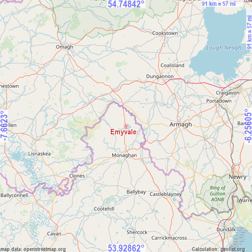
Emyvale GPS coordinates[2]
54° 20' 26.016" North, 6° 57' 33.012" West
| Map corner | latitude | longitude |
|---|---|---|
| Upper-left | 54.74842°, | -7.6623° |
| Center: | 54.34056°, | -6.95917° |
| Lower-right: | 53.92862°, | -6.25605° |
| Map W x H: | 91.2×91.2 km | = 56.7×56.7mi |
| max Lat: | 55.25° ⇑6.6% North |
| Emyvale: | 54.34056° |
| min Lat: | ⇓93.4% South 51.52487° |
| min Long | Emyvale | max Long |
| -10.26889° | -6.95917° | -6.04944° |
| W 60.7%⇐ | ⇒39.3% E |
Elevation
Elevation of Emyvale is 55 m = 180 ft, and this is 0.5 m = 2 ft above average elevation for this country.
| Max E: |
262 m = 860 ft | 45.9% |
| Emyvale | 55 m 180 ft | |
| Avg. | 54.5 m = 179 ft | |
Min E: |
0 m = 0 ft | 54.1% |
See also: Ireland elevation on elevation.city.
Geographical zone
Emyvale is located in North temperate zone (between Tropic of Cancer and the Arctic Circle). Distance of this North polar circle is 1359.1 km =844.5 mi to North.| Distance of | km | miles | from Emyvale |
|---|---|---|---|
| North Pole | 3965 | 2463.7 | to North |
| Arctic Circle | 1359.1 | 844.5 | to North |
| Tropic Cancer | 3436.2 | 2135.2 | to South |
| Equator | 6042.1 | 3754.4 | to South |


Nearby cities:
15 places around Emyvale: (largest is in red/bold)
• Bailieborough
47.1 km =29.3 mi,  180°
180°
• Ballyconnell
47.6 km =29.6 mi,  238°
238°
• Ballyhaise
39.8 km =24.7 mi,  215°
215°
• Belturbet
41.6 km =25.8 mi,  230°
230°
• Carrickmacross
43.8 km =27.2 mi,  159°
159°
• Castleblayney
28.9 km =18 mi,  149°
149°
• Cavan
46.8 km =29.1 mi,  213°
213°
• Clones
25 km =15.5 mi, 225°
• Cootehill
30.9 km =19.2 mi,  194°
194°
• Dundalk
51.8 km =32.2 mi,  137°
137°
• Kingscourt
49.1 km =30.5 mi,  168°
168°
• Knockbridge
51.2 km =31.8 mi, 142°
• Louth
51.4 km =31.9 mi, 148°
• Monaghan
10.1 km =6.3 mi, 182°
• Shercock
38.1 km =23.7 mi, 174°
Sources, notices
• [Note1] Compared only with cities in Ireland existing in our database
• [Src1] Map data: © OpenStreetMap contributors (CC-BY-SA)
• [Src2] Other city data from geonames.org with taken over terms of usage.
• [Src3] Geographical zone / Annual Mean Temperature by Robert A. Rohde @ Wikipedia
