Ballivor geodata
Ballivor (Leinster) is a populated place; located in Ireland in Europe/Dublin (GMT+1) time zone. With population of 1,727 people, there are 250 cities with bigger population in this country. Compared to other cities in Ireland, 73.4% of cities are located further ↓South; 60.5% of cities are located further ←West and 66% of cities have lower elevation than Ballivor. Note1


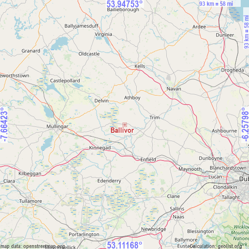
Ballivor GPS coordinates[2]
53° 31' 54.012" North, 6° 57' 39.996" West
| Map corner | latitude | longitude |
|---|---|---|
| Upper-left | 53.94753°, | -7.66423° |
| Center: | 53.53167°, | -6.96111° |
| Lower-right: | 53.11168°, | -6.25798° |
| Map W x H: | 92.9×92.9 km | = 57.7×57.7mi |
| max Lat: | 55.25° ⇑26.6% North |
| Ballivor: | 53.53167° |
| min Lat: | ⇓73.4% South 51.52487° |
| min Long | Ballivor | max Long |
| -10.26889° | -6.96111° | -6.04944° |
| W 60.5%⇐ | ⇒39.5% E |
Elevation
Elevation of Ballivor is 65 m = 213 ft, and this is 10.5 m = 34 ft above average elevation for this country.
| Max E: |
262 m = 860 ft | 34% |
| Ballivor | 65 m 213 ft | |
| Avg. | 54.5 m = 179 ft | |
Min E: |
0 m = 0 ft | 66% |
See also: Ireland elevation on elevation.city.
Geographical zone
Ballivor is located in North temperate zone (between Tropic of Cancer and the Arctic Circle). Distance of this North polar circle is 1449 km =900.4 mi to North.| Distance of | km | miles | from Ballivor |
|---|---|---|---|
| North Pole | 4054.9 | 2519.6 | to North |
| Arctic Circle | 1449 | 900.4 | to North |
| Tropic Cancer | 3346.2 | 2079.2 | to South |
| Equator | 5952.2 | 3698.5 | to South |


Nearby cities:
15 places around Ballivor: (largest is in red/bold)
• Athboy
10.6 km =6.6 mi,  16°
16°
• Clonmellon
15.2 km =9.4 mi,  345°
345°
• Delvin
12.3 km =7.6 mi,  315°
315°
• Derrinturn
21.2 km =13.2 mi,  176°
176°
• Edenderry
22.1 km =13.7 mi,  194°
194°
• Enfield
15.6 km =9.7 mi,  146°
146°
• Johnstown Bridge
15.7 km =9.8 mi, 154°
• Kildalkey
5.7 km =3.5 mi,  40°
40°
• Kilmessan
20.2 km =12.6 mi,  81°
81°
• Kinnegad
12.7 km =7.9 mi,  226°
226°
• Longwood
9 km =5.6 mi,  163°
163°
• Newtown Trim
12.9 km =8 mi, 77°
• Rathwire
11.8 km =7.3 mi,  256°
256°
• Summerhill
16.1 km =10 mi,  112°
112°
• Trim
11.5 km =7.1 mi, 76°
Sources, notices
• [Note1] Compared only with cities in Ireland existing in our database
• [Src1] Map data: © OpenStreetMap contributors (CC-BY-SA)
• [Src2] Other city data from geonames.org with taken over terms of usage.
• [Src3] Geographical zone / Annual Mean Temperature by Robert A. Rohde @ Wikipedia
